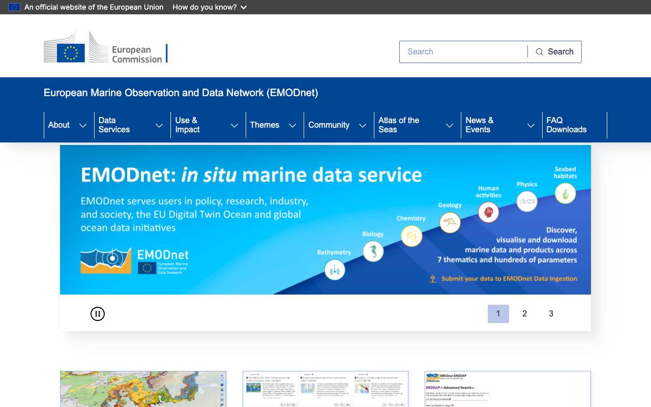
EMODnet (Europese zeedata)
Het Europese netwerk voor zeedata in zeven thema's: diepte, geologie, fysica, chemie, biologie, zeebodemleefgebieden en menselijk gebruik. Voor de Nederlandse Noordzee vind je hier windparken, kabels, leidingen, scheepvaartdichtheid, wrakken en de diepte, als kaartlaag (WMS) en als data (WFS).
Wat er allemaal in zit1.891
Alle lagen uit de kaart- en objectdiensten van EMODnet, per thema, elke nacht opgehaald. Geologie en fysica ontbreken: hun servers verbieden scripts in robots.txt. De titels zijn Engels, zoals de bron ze publiceert.
Biologie (Biology)122
Chemie (Chemistry)1.106
Zeebodemleefgebieden (Seabed Habitats)438
Windparkgebieden in het Nederlandse deel van de Noordzee naar status: gepland is het grootste deel, 51% in oktober 2026
Verdeling in oktober 2026: gepland 51%, in productie 31%, in aanbouw 13%, vergund 5,1%. Totaal: 39 gebieden.
Windparken op zee in productie (Nederlands deel Noordzee) naar vermogen: het meest Hollandse Kust (Zuid) (1.540 megawatt), dan Hollandse Kust (Noord) en Borssele Kavel IV
Windparken op zee in productie (Nederlands deel Noordzee) naar vermogen, oktober 2026, in megawatt. Totaal: 4.759; de grootste 12 van 12 categorieën staan in de grafiek. Hollandse Kust (Zuid) is 32% van het totaal. 12 parken met status "Production", samen 671 turbines. EMODnet werkt de laag één keer per jaar bij (nieuwste updateyear: 2026); een park dat net open is, kan er nog als "in aanbouw" in staan.
Wat kun je ermee?4 ideeën
Windparken op de Nederlandse Noordzee
Volgens EMODnet draaien er in Nederland 12 windparken op zee met samen 4.758,5 MW en 671 turbines. Vijf parken (3.556 MW) zijn in aanbouw en twintig gepland (laag windparken, peildatum metadata juli 2026).
Hoe diep is het hier?
Eén aanroep geeft de diepte op een punt. Op 4,0° oost, 52,6° noord (voor de kust van Noord-Holland) is het gemiddeld 26,5 meter.
Drukte op zee naast de windparken
Leg de laag scheepvaartdichtheid (vesseldensity) over de windparken en de kabels. Waar kruisen scheepvaartroutes en geplande parken?
Afstand tot de kust
Elk windpark heeft een veld dist_coast in meters. Zet de Nederlandse parken naast die van Duitsland, Denemarken en het Verenigd Koninkrijk.
Zo verwerk je het4 stappen
Kies het juiste thema-portaal
Elk thema heeft een eigen server, bv. ows.emodnet-humanactivities.eu (windparken, kabels, scheepvaart) en ows.emodnet-bathymetry.eu (diepte). De documentatie noemt alle WMS-, WFS- en WCS-adressen.
https://emodnet.ec.europa.eu/en/emodnet-web-service-documentation
Bekijk de lagen
De WFS van Human Activities noemt 161 lagen (de WMS 208, 16 okt 2026), van windparken (emodnet:windfarmspoly) tot kabels van Rijkswaterstaat (emodnet:pcablesrijks).
https://ows.emodnet-humanactivities.eu/wfs?service=WFS&request=GetCapabilities&version=2.0.0
Filter op Nederland
GeoServer kent CQL_FILTER: country='Netherlands'. Met propertyName kies je de velden; outputFormat=csv of application/json.
https://ows.emodnet-humanactivities.eu/wfs?service=WFS&version=2.0.0&request=GetFeature&typeNames=emodnet:windfarmspoly&outputFormat=csv&CQL_FILTER=country='Netherlands'&propertyName=name,status,power_mw,n_turbines,year
Diepte op een punt
De REST-dienst van Bathymetry geeft minimum, maximum en gemiddelde diepte (in meters, negatief = onder zeeniveau) en de bron van de meting.
https://rest.emodnet-bathymetry.eu/depth_sample?geom=POINT(4.0%2052.6)
Interessante koppelingen

Vergelijkbare bronnen
- NNoordzeeloket (Rijksoverheid) nog niet uitgelegd
Het portaal van de Nederlandse overheid voor de Noordzee, met het Programma Noordzee en windenergie op zee. Wel de plannen en besluiten, geen Europese datalagen.
 Copernicus Sentinel-2
Satellietbeelden van zee en kust; geen diepte, kabels of vergunningen.
Waar je op moet letten
- Status loopt achter op de praktijk
De laag windparken wordt één keer per jaar bijgewerkt (veld updateyear). Een park dat net open is kan nog op 'Construction' staan. Controleer recente parken bij Noordzeeloket of de exploitant.
- EMODnet verzamelt, maakt niet zelf
De data komen van nationale instituten. De licentie is CC BY 4.0 tenzij anders vermeld, maar lees de metadata van de oorspronkelijke bron en vermeld die.
- Elk thema een andere server
Bathymetry, Human Activities, Geology en de andere thema's hebben elk hun eigen adres, lagen en naamgeving. Begin bij de documentatiepagina.
- Diepte is een gemiddelde per cel
Het diepteraster heeft cellen van ongeveer 125 meter. Voor scheepvaart of bouw gebruik je de officiële zeekaarten.
APIOGC WFS 2.0.0 · gelezen 16 okt 2026
Geen sleutel. Kosten: NONE; gebruiksvoorwaarden: NONE. uit de beschrijving
objecten in emodnet:windfarmspoly getest
application/gml+xml; version=3.2GML2SHAPE-ZIPapplication/jsoncsvgml3gml32jsontext/csvtext/xml; subtype=gml/2.1.2text/xml; subtype=gml/3.1.1text/xml; subtype=gml/3.2
Basisadres
https://ows.emodnet-humanactivities.eu/wfs
Endpoints 11
- GET
?request=GetCapabilitiesbeschrijving van de dienst - GET
?request=DescribeFeatureTypevelden van een laag (XSD) - GET
?request=GetFeaturede objecten zelf, met geometrie - GET
?request=GetPropertyValuealleen de waarden van één veld - GET
?request=ListStoredQueriesopgeslagen zoekvragen - GET
?request=DescribeStoredQueriesuitleg bij opgeslagen zoekvragen - GET
?request=CreateStoredQueryCreateStoredQuery - GET
?request=DropStoredQueryDropStoredQuery - GET
?request=LockFeatureLockFeature - GET
?request=GetFeatureWithLockGetFeatureWithLock - GET
?request=TransactionTransaction
Lagen en projecties
- Active Licences
emodnet:activelicensesEPSG:4326 - Advisory Councils
emodnet:advisorycouncilsEPSG:4326 - Advisory Councils (Pelagic Stocks)
emodnet:pelagicstocksEPSG:4326 - Advisory Councils (Aquaculture)
emodnet:aquacultureEPSG:4326 - Advisory Councils (Baltic)
emodnet:balticEPSG:4326 - Advisory Councils (Black Sea)
emodnet:blackseaEPSG:4326 - Advisory Councils (Long Distance Fleet)
emodnet:longdistancefleetEPSG:4326 - Advisory Councils (Market)
emodnet:marketEPSG:4326 - Advisory Councils (Mediterranean)
emodnet:mediterraneanEPSG:4326 - Advisory Councils (North Sea)
emodnet:northseaEPSG:4326 - Advisory Councils (North-western Waters)
emodnet:northwesternwatersEPSG:4326 - Advisory Councils (Outermost Regions)
emodnet:outermostregionsEPSG:4326 - Advisory Councils (South-western Waters)
emodnet:southwesternwatersEPSG:4326 - Aggregate Extraction Areas
emodnet:aggregateareasEPSG:4326 - Aggregate Extraction Locations
emodnet:aggregatesEPSG:4326 - Average MW Fishing hours: Beam trawls
emodnet:fishingbeamtrawlsEPSG:4326 - Average MW Fishing hours: Bottom otter trawls
emodnet:fishingbottomottertrawlsEPSG:4326 - Average MW Fishing hours: Bottom seines
emodnet:fishingbottomseinesEPSG:4326 - Average MW Fishing hours: Dredges
emodnet:fishingdredgesEPSG:4326 - Average MW Fishing hours: Pelagic trawls and seines
emodnet:fishingpelagicEPSG:4326 - Average MW Fishing hours: Static gears
emodnet:fishingstaticgearsEPSG:4326 - Average Subsurface Swept Area Ratio
emodnet:fishingsubsurfaceEPSG:4326 - Average Surface Swept Area Ratio
emodnet:fishingsurfaceEPSG:4326 - Barcelona Convention
emodnet:barcelonaEPSG:4326 - Boreholes
emodnet:hydrocarbonsEPSG:4326 - Bucharest Convention
emodnet:bucharestEPSG:4326 - Desalination Plants
emodnet:desalinationEPSG:4326 - Discharge Points
emodnet:dischargepointsEPSG:4326 - Dredge Spoil Dumping (Points)
emodnet:dredgespoilEPSG:4326 - Dredge Spoil Dumping (Polygons)
emodnet:dredgespoilpolyEPSG:4326 - Dredging
emodnet:dredgingEPSG:4326 - Dumped Munitions (Points)
emodnet:munitionsEPSG:4326 - Dumped Munitions (Polygons)
emodnet:munitionspolyEPSG:4326 - EMODnet Marinas
emodnet:emodnetmarinasEPSG:4326 - Emerald Network
emodnet:emeraldnetworkEPSG:4326 - FAO Statistical Areas
emodnet:faoareas_oldEPSG:4326 - FAO Statistical Areas for Fishery Purposes
emodnet:fao_areasEPSG:4326 - Finfish Production
emodnet:finfishEPSG:4326 - First Sales of Fish
emodnet:fishsalesEPSG:4326 - First Sales of Fish by Species
emodnet:fishsalesbyspeciesEPSG:4326 - Fish Catches by FAO Fishery Statistical Areas (Division Area)
emodnet:divisioncatchesEPSG:4326 - Fish Catches by FAO Fishery Statistical Areas (Major Area)
emodnet:majorcatchesEPSG:4326 - Fish Catches by FAO Fishery Statistical Areas (Sub-area Area)
emodnet:subareacatchesEPSG:4326 - Fish Catches by FAO Fishery Statistical Areas (Sub-division Area)
emodnet:subdivisioncatchesEPSG:4326 - Fish Catches by FAO Fishery Statistical Areas (Sub-unit Area)
emodnet:subunitcatchesEPSG:4326 - Fish Catches by FAO Fishery Statistical Areas and Commodity Group (Division Area)
emodnet:divisioncatchesbygroupEPSG:4326 - Fish Catches by FAO Fishery Statistical Areas and Commodity Group (Major Area)
emodnet:majorcatchesbygroupEPSG:4326 - Fish Catches by FAO Fishery Statistical Areas and Commodity Group (Sub-area Area)
emodnet:subareacatchesbygroupEPSG:4326 - Fish Catches by FAO Fishery Statistical Areas and Commodity Group (Sub-division Area)
emodnet:subdivisioncatchesbygroupEPSG:4326 - Fish Catches by FAO Fishery Statistical Areas and Commodity Group (Sub-unit Area)
emodnet:subunitcatchesbygroupEPSG:4326 - Fish Catches by FAO Fishery Statistical Areas and Country (Division Area)
emodnet:divisioncatchesbycountryEPSG:4326 - Fish Catches by FAO Fishery Statistical Areas and Country (Major Area)
emodnet:majorcatchesbycountryEPSG:4326 - Fish Catches by FAO Fishery Statistical Areas and Country (Sub-area Area)
emodnet:subareacatchesbycountryEPSG:4326 - Fish Catches by FAO Fishery Statistical Areas and Country (Sub-division Area)
emodnet:subdivisioncatchesbycountryEPSG:4326 - Fish Catches by FAO Fishery Statistical Areas and Country (Sub-unit Area)
emodnet:subunitcatchesbycountryEPSG:4326 - Fishing Effort by FAO Areas/GFCM Subareas (Division)
emodnet:divisioneffortEPSG:4326 - Fishing Effort by FAO Areas/GFCM Subareas (GFCM Sub-area)
emodnet:gfcmsubareaeffortEPSG:4326 - Fishing Effort by FAO Areas/GFCM Subareas (Major)
emodnet:majoreffortEPSG:4326 - Fishing Effort by FAO Areas/GFCM Subareas (Sub-area)
emodnet:subareaeffortEPSG:4326 - Fishing Effort by FAO Areas/GFCM Subareas (Sub-division)
emodnet:subdivisioneffortEPSG:4326 - Fishing Effort by FAO Areas/GFCM Subareas (Sub-unit)
emodnet:subuniteffortEPSG:4326 - Fishing Effort by FAO Areas/GFCM Subareas and Country (Division Area) Ver1
emodnet:divisioneffortbycountryv1EPSG:4326 - Fishing Effort by FAO Areas/GFCM Subareas and Country (Division)
emodnet:divisioneffortbycountryEPSG:4326 - Fishing Effort by FAO Areas/GFCM Subareas and Country (GFCM Sub-area)
emodnet:gfcmsubareaeffortbycountryEPSG:4326 - Fishing Effort by FAO Areas/GFCM Subareas and Country (GFCM Subarea) Ver 1
emodnet:gfcmsubareaeffortbycountryv1EPSG:4326 - Fishing Effort by FAO Areas/GFCM Subareas and Country (Major Area) Ver 1
emodnet:majoreffortbycountryv1EPSG:4326 - Fishing Effort by FAO Areas/GFCM Subareas and Country (Major)
emodnet:majoreffortbycountryEPSG:4326 - Fishing Effort by FAO Areas/GFCM Subareas and Country (Sub-area Area) Ver 1
emodnet:subareaeffortbycountryv1EPSG:4326 - Fishing Effort by FAO Areas/GFCM Subareas and Country (Sub-area)
emodnet:subareaeffortbycountryEPSG:4326 - Fishing Effort by FAO Areas/GFCM Subareas and Country (Sub-division Area) Ver 1
emodnet:subdivisioneffortbycountryv1EPSG:4326 - Fishing Effort by FAO Areas/GFCM Subareas and Country (Sub-division)
emodnet:subdivisioneffortbycountryEPSG:4326 - Fishing Effort by FAO Areas/GFCM Subareas and Country (Sub-unit Area) Ver1
emodnet:subuniteffortbycountryv1EPSG:4326 - Fishing Effort by FAO Areas/GFCM Subareas and Country (Sub-unit)
emodnet:subuniteffortbycountryEPSG:4326 - Fishing Effort by FAO Areas/GFCM Subareas and Vessel Type (Division Area) Ver 1
emodnet:divisioneffortbyvesseltypev1EPSG:4326 - Fishing Effort by FAO Areas/GFCM Subareas and Vessel Type (Division)
emodnet:divisioneffortbyvesseltypeEPSG:4326 - Fishing Effort by FAO Areas/GFCM Subareas and Vessel Type (GFCM Sub-area
emodnet:gfcmsubareaeffortbyvesseltypeEPSG:4326 - Fishing Effort by FAO Areas/GFCM Subareas and Vessel Type (GFCM Subarea) Ver 1
emodnet:gfcmsubareaeffortbyvesseltypev1EPSG:4326 - Fishing Effort by FAO Areas/GFCM Subareas and Vessel Type (Major Area) Ver 1
emodnet:majoreffortbyvesseltypev1EPSG:4326 - Fishing Effort by FAO Areas/GFCM Subareas and Vessel Type (Major)
emodnet:majoreffortbyvesseltypeEPSG:4326 - Fishing Effort by FAO Areas/GFCM Subareas and Vessel Type (Sub-area Area) Ver 1
emodnet:subareaeffortbyvesseltypev1EPSG:4326 - Fishing Effort by FAO Areas/GFCM Subareas and Vessel Type (Sub-area)
emodnet:subareaeffortbyvesseltypeEPSG:4326 - Fishing Effort by FAO Areas/GFCM Subareas and Vessel Type (Sub-division Area) Ver 1
emodnet:subdivisioneffortbyvesseltypev1EPSG:4326 - Fishing Effort by FAO Areas/GFCM Subareas and Vessel Type (Sub-division)
emodnet:subdivisioneffortbyvesseltypeEPSG:4326 - Fishing Effort by FAO Areas/GFCM Subareas and Vessel Type (Sub-unit Area) Ver 1
emodnet:subuniteffortbyvesseltypev1EPSG:4326 - Fishing Effort by FAO Areas/GFCM Subareas and Vessel Type (Sub-unit)
emodnet:subuniteffortbyvesseltypeEPSG:4326 - Fishing Effort by FAO Fishery Statistical Areas and GFCM Subareas (Division) Ver 1
emodnet:divisioneffortv1EPSG:4326 - Fishing Effort by FAO Fishery Statistical Areas and GFCM Subareas (GFCM Sub-area) Ver 1
emodnet:gfcmsubareaeffortv1EPSG:4326 - Fishing Effort by FAO Fishery Statistical Areas and GFCM Subareas (Major) Ver 1
emodnet:majoreffortv1EPSG:4326 - Fishing Effort by FAO Fishery Statistical Areas and GFCM Subareas (Sub-area) Ver1
emodnet:subareaeffortv1EPSG:4326 - Fishing Effort by FAO Fishery Statistical Areas and GFCM Subareas (Sub-division) Ver 1
emodnet:subdivisioneffortv1EPSG:4326 - Fishing Effort by FAO Fishery Statistical Areas and GFCM Subareas (Sub-unit) Ver 1
emodnet:subuniteffortv1EPSG:4326 - Fishing Quotas by FMZs
emodnet:fishquotasEPSG:4326 - Fishing Quotas by FMZs
emodnet:fishquotas240408EPSG:4326 - Fishing Quotas by FMZs and Level
emodnet:fishquotas240408bylevelEPSG:4326 - Fishing Quotas by FMZs and Level
emodnet:fishquotasbylevelEPSG:4326 - Fishing Quotas by FMZs and Species
emodnet:fishquotas240408byspeciesEPSG:4326 - Fishing Quotas by FMZs and Species
emodnet:fishquotasbyspeciesEPSG:4326 - Freshwater Production
emodnet:freshwaterEPSG:4326 - HELCOM Maritime Area
emodnet:helcomEPSG:4326 - Heritage Ship Wrecks
emodnet:heritageshipwrecksEPSG:4326 - ICES Statistical Areas
emodnet:icesareasEPSG:4326 - International Conventions
emodnet:intconventionsEPSG:4326 - Lighthouses
emodnet:lighthousesEPSG:4326 - MSFD Reporting Units
emodnet:reportingunitsEPSG:4326 - MSP Spatial Plan Areas
emodnet:mspspatialplanEPSG:4326 - MSP Zoning Areas by Function
emodnet:mspzoningpolybyusefunctionEPSG:4326 - MSP Zoning Areas by Planned Marine Use
emodnet:mspzoningpolyEPSG:4326 - MSP Zoning Lines by Function
emodnet:mspzoninglinebyusefunctionEPSG:4326 - MSP Zoning Lines by Planned Marine Use
emodnet:mspzoninglineEPSG:4326 - MSP Zoning Points by Function
emodnet:mspzoninglocsbyusefunctionEPSG:4326 - MSP Zoning Points by Planned Marine Use
emodnet:mspzoninglocsEPSG:4326 - Macroalgae (seaweeds)
emodnet:macroalgaeEPSG:4326 - Main Ports (Goods Traffic 1997-2025)
emodnet:portgoodsEPSG:4326 - Main Ports (Locations Only)
emodnet:portlocationsEPSG:4326 - Main Ports (Passengers Traffic 1997-2025)
emodnet:portpassengersEPSG:4326 - Main Ports (Vessles Traffic 1997-2025)
emodnet:portvesselsEPSG:4326 - Main Ports (Vessles Traffic by Tonnage 1997-2025)
emodnet:portvesselsbytonnageEPSG:4326 - Main Ports (Vessles Traffic by Type 1997-2025)
emodnet:portvesselsbytypeEPSG:4326 - Microalgae
emodnet:microalgaeEPSG:4326 - Military Areas (Points)
emodnet:militaryareasEPSG:4326 - Military Areas (Polygons)
emodnet:militaryareaspolyEPSG:4326 - Nationally Designated Areas
emodnet:cddaareasEPSG:4326 - Nationally Designated Areas (Locations)
emodnet:cddalocationsEPSG:4326 - Nationally Designated Areas (Points)
emodnet:nationallydesignatedlocsEPSG:4326 - Nationally Designated Areas (Polygons)
emodnet:nationallydesignatedareasEPSG:4326 - Natura 2000
emodnet:natura2000areasEPSG:4326 - Nuclear Power Plants
emodnet:nuclearEPSG:4326 - Number of nights spent by municipality (LAU)
emodnet:tourismlauEPSG:4326 - OSPAR Maritime Area
emodnet:osparEPSG:4326 - Ocean Energy - Project Locations
emodnet:oenergyEPSG:4326 - Ocean Energy - Test Sites
emodnet:oenergytestsEPSG:4326 - Offshore Installations
emodnet:platformsEPSG:4326 - OpenStreetMap Marinas (areas)
emodnet:osmmarinaspolyEPSG:4326 - OpenStreetMap Marinas (points)
emodnet:osmmarinasEPSG:4326 - Pipelines
emodnet:pipelinesEPSG:4326 - Power Cables - DE BSH-CONTIS
emodnet:pcablesbshcontisEPSG:4326 - Power Cables - FR SHOM
emodnet:pcablesshomEPSG:4326 - Power Cables - NL Rijkswaterstaat
emodnet:pcablesrijksEPSG:4326 - Power Cables - NO NVE
emodnet:pcablesnveEPSG:4326 - Regional Sea Conventions MPAs
emodnet:marineprotectedareasEPSG:4326 - Shellfish Aquaculture Licensed Sites
emodnet:shellfishlicsEPSG:4236 - Shellfish Production
emodnet:shellfishEPSG:4326 - Shellfish Protected Areas under the WFD
emodnet:shellfishwfdareasEPSG:4326 - Spirulina
emodnet:spirulinaEPSG:4326 - State of Bathing Waters
emodnet:bathingwatersEPSG:4326 - Telecommunication Cables - DE BSH-CONTIS
emodnet:bshcontiscablesEPSG:4326 - Telecommunication Cables - ES CICA
emodnet:cicacablesEPSG:4326 - Telecommunication Cables - FR SHOM
emodnet:shomcablesEPSG:4326 - Telecommunication Cables - FR SIGCables
emodnet:sigcablesEPSG:4326 - Telecommunication Cables - MT IOI-MOC
emodnet:maltacablesEPSG:4326 - Telecommunication Cables - NL Rijkswaterstaat
emodnet:rijkscablesEPSG:4326 - Telecommunication Cables - UK OGA
emodnet:ukfibrecablesEPSG:4326 - Tourism ecosystem indicators by NUTS3 region
emodnet:tourismnuts3EPSG:4326 - Treatment Plants
emodnet:treatmentplantsEPSG:4326 - UNESCO World Heritage Convention
emodnet:unescowhlEPSG:4326 - Waste at Ports (m3/tonnes)
emodnet:wasteatportsEPSG:4326 - Wind Farms (Points)
emodnet:windfarmsEPSG:4326 - Wind Farms (Polygons)
emodnet:windfarmspolyEPSG:4326 - World Database on Protected Areas
emodnet:wdpaareasEPSG:4326 - World Database on Protected Areas (Locations)
emodnet:wdpalocationsEPSG:4326 - Worldwide wreck locations (UK Hydrographic Office)
emodnet:wwshipwrecksEPSG:4326
Filteren uit de beschrijving
OGC Filter Encoding (FES 2.0)
Parameters 6
typeNames | welke laag: emodnet:activelicenses, emodnet:advisorycouncils, emodnet:pelagicstocks, emodnet:aquaculture, emodnet:baltic, emodnet:blacksea, emodnet:longdistancefleet, emodnet:market, emodnet:mediterranean, emodnet:northsea, emodnet:northwesternwaters, emodnet:outermostregions, emodnet:southwesternwaters, emodnet:aggregateareas, emodnet:aggregates, emodnet:fishingbeamtrawls, emodnet:fishingbottomottertrawls, emodnet:fishingbottomseines, emodnet:fishingdredges, emodnet:fishingpelagic, emodnet:fishingstaticgears, emodnet:fishingsubsurface, emodnet:fishingsurface, emodnet:barcelona, emodnet:hydrocarbons, emodnet:bucharest, emodnet:desalination, emodnet:dischargepoints, emodnet:dredgespoil, emodnet:dredgespoilpoly, emodnet:dredging, emodnet:munitions, emodnet:munitionspoly, emodnet:emodnetmarinas, emodnet:emeraldnetwork, emodnet:faoareas_old, emodnet:fao_areas, emodnet:finfish, emodnet:fishsales, emodnet:fishsalesbyspecies, emodnet:divisioncatches, emodnet:majorcatches, emodnet:subareacatches, emodnet:subdivisioncatches, emodnet:subunitcatches, emodnet:divisioncatchesbygroup, emodnet:majorcatchesbygroup, emodnet:subareacatchesbygroup, emodnet:subdivisioncatchesbygroup, emodnet:subunitcatchesbygroup, emodnet:divisioncatchesbycountry, emodnet:majorcatchesbycountry, emodnet:subareacatchesbycountry, emodnet:subdivisioncatchesbycountry, emodnet:subunitcatchesbycountry, emodnet:divisioneffort, emodnet:gfcmsubareaeffort, emodnet:majoreffort, emodnet:subareaeffort, emodnet:subdivisioneffort, emodnet:subuniteffort, emodnet:divisioneffortbycountryv1, emodnet:divisioneffortbycountry, emodnet:gfcmsubareaeffortbycountry, emodnet:gfcmsubareaeffortbycountryv1, emodnet:majoreffortbycountryv1, emodnet:majoreffortbycountry, emodnet:subareaeffortbycountryv1, emodnet:subareaeffortbycountry, emodnet:subdivisioneffortbycountryv1, emodnet:subdivisioneffortbycountry, emodnet:subuniteffortbycountryv1, emodnet:subuniteffortbycountry, emodnet:divisioneffortbyvesseltypev1, emodnet:divisioneffortbyvesseltype, emodnet:gfcmsubareaeffortbyvesseltype, emodnet:gfcmsubareaeffortbyvesseltypev1, emodnet:majoreffortbyvesseltypev1, emodnet:majoreffortbyvesseltype, emodnet:subareaeffortbyvesseltypev1, emodnet:subareaeffortbyvesseltype, emodnet:subdivisioneffortbyvesseltypev1, emodnet:subdivisioneffortbyvesseltype, emodnet:subuniteffortbyvesseltypev1, emodnet:subuniteffortbyvesseltype, emodnet:divisioneffortv1, emodnet:gfcmsubareaeffortv1, emodnet:majoreffortv1, emodnet:subareaeffortv1, emodnet:subdivisioneffortv1, emodnet:subuniteffortv1, emodnet:fishquotas, emodnet:fishquotas240408, emodnet:fishquotas240408bylevel, emodnet:fishquotasbylevel, emodnet:fishquotas240408byspecies, emodnet:fishquotasbyspecies, emodnet:freshwater, emodnet:helcom, emodnet:heritageshipwrecks, emodnet:icesareas, emodnet:intconventions, emodnet:lighthouses, emodnet:reportingunits, emodnet:mspspatialplan, emodnet:mspzoningpolybyusefunction, emodnet:mspzoningpoly, emodnet:mspzoninglinebyusefunction, emodnet:mspzoningline, emodnet:mspzoninglocsbyusefunction, emodnet:mspzoninglocs, emodnet:macroalgae, emodnet:portgoods, emodnet:portlocations, emodnet:portpassengers, emodnet:portvessels, emodnet:portvesselsbytonnage, emodnet:portvesselsbytype, emodnet:microalgae, emodnet:militaryareas, emodnet:militaryareaspoly, emodnet:cddaareas, emodnet:cddalocations, emodnet:nationallydesignatedlocs, emodnet:nationallydesignatedareas, emodnet:natura2000areas, emodnet:nuclear, emodnet:tourismlau, emodnet:ospar, emodnet:oenergy, emodnet:oenergytests, emodnet:platforms, emodnet:osmmarinaspoly, emodnet:osmmarinas, emodnet:pipelines, emodnet:pcablesbshcontis, emodnet:pcablesshom, emodnet:pcablesrijks, emodnet:pcablesnve, emodnet:marineprotectedareas, emodnet:shellfishlics, emodnet:shellfish, emodnet:shellfishwfdareas, emodnet:spirulina, emodnet:bathingwaters, emodnet:bshcontiscables, emodnet:cicacables, emodnet:shomcables, emodnet:sigcables, emodnet:maltacables, emodnet:rijkscables, emodnet:ukfibrecables, emodnet:tourismnuts3, emodnet:treatmentplants, emodnet:unescowhl, emodnet:wasteatports, emodnet:windfarms, emodnet:windfarmspoly, emodnet:wdpaareas, emodnet:wdpalocations, emodnet:wwshipwrecks | uit de beschrijving |
outputFormat | bv. application/json voor GeoJSON | uit de beschrijving |
srsName | projectie, bv. EPSG:4326 voor webkaarten (standaard EPSG:4326) | uit de beschrijving |
count / startIndex | pagineren | uit de beschrijving |
filter | FES-XML-filter op velden of geometrie | uit de beschrijving |
bbox | rechthoek in de gekozen projectie | platform |
Velden 13 · emodnet:windfarmspoly
| Naam | Type | Betekenis |
|---|---|---|
country | string | |
n_turbines | int | |
power_mw | decimal | |
status | string | |
type_inst | string | |
updateyear | string | |
year | string | |
dist_coast | decimal | |
area_sqkm | decimal | |
notes | string | |
shape_leng | decimal | |
shape_area | decimal |
Toon alle 13
| Naam | Type | Betekenis |
|---|---|---|
the_geom | geometrie |
Limieten en valkuilen
- Maximaal 1.000.000 objecten per verzoek (CountDefault). uit de beschrijving
- Pagineren kan: count en startIndex (ImplementsResultPaging). uit de beschrijving
- De hele laag windparken (600 objecten in Europa) komt in één verzoek; pagineren is voor deze laag niet nodig. getest
- Filteren gaat het makkelijkst met de GeoServer-parameter CQL_FILTER, bv. country='Netherlands' AND status='Production' (12 parken, 15 okt 2026). getest
- Met propertyName zonder the_geom komt geometry: null terug: handig als je alleen de tabel wilt. getest
- outputFormat=csv werkt ook en geeft een kolom FID plus de gekozen velden. getest
- dist_coast is in meters, power_mw in megawatt. Statussen: Production, Construction, Approved, Planned (en in andere landen ook Dismantled en Test site). uit de beschrijving
Probeer het HTTP 200 · 259 ms · 16 okt
https://ows.emodnet-humanactivities.eu/wfs?service=WFS&version=2.0.0&request=GetFeature&typeNames=emodnet:windfarmspoly&outputFormat=application/json&count=2&CQL_FILTER=country='Netherlands' AND status='Production'&propertyName=name,status,power_mw,n_turbines,year
{
  "type": "FeatureCollection",
  "features": [
    {
      "type": "Feature",
      "id": "windfarmspoly.80",
      "geometry": null,
      "properties": {
        "name": "Borssele Kavel V",
        "n_turbines": 2,
        "power_mw": 19,
        "status": "Production",
        "year": "2020"
      }
    },
    {
      "type": "Feature",
      "id": "windfarmspoly.221",
      "geometry": null,
      "properties": {
        "name": "Buitengaats / Gemini I",
        "n_turbines": 75,
        "power_mw": 300,
        "status": "Production",
        "year": "2016"
      }
    }
  ],
  "totalFeatures": 12,
  "numberMatched": 12,
  "numberReturned": 2,
  "timeStamp": "2026-10-16T06:03:37.864Z",
  "crs": null
}
Ingekort antwoord, opgeslagen bij het oogsten. Klik op het adres voor het echte, actuele antwoord.
Gelezen uit GetCapabilities: lagen, projecties, formaten, filters, limiet · DescribeFeatureType: velden van emodnet:windfarmspoly. Labels: uit de beschrijving staat in wat de api zelf publiceert. getest uit onze eigen kleine aanroep. platform geldt voor elk api van dit platform, volgens de documentatie. ervaring zelf ondervonden bij het bouwen van open data index.
Zo haal je het op
curl "https://ows.emodnet-humanactivities.eu/wfs?service=WFS&version=2.0.0&request=GetFeature&typeNames=emodnet:windfarmspoly&outputFormat=csv&CQL_FILTER=country='Netherlands'&propertyName=name,status,power_mw,n_turbines,year"
Meer van EMODnet in onze index
1.891 datasets in EMODnet. Dit zijn de laatst gewijzigde.
- Natura 20002020-01-31
- [FI004005] Potential spawning areas for herring (PBS EFH)2018-10-29
- State of Bathing Waters2006-02-15
- [FI004008] Potential recruitment areas for pikeperch (PBS EFH)2001-11-29
- [FI004002] Potential spawning areas for Baltic flounder (PBS EFH)2001-11-29
- [FI004003] Potential spawning areas for European flounder (PBS EFH)2001-11-29
Meer in dit thema

Bekijk hoe deze pagina is opgebouwd
bron: emodnet
blokken: []
secties:
  - ideeen
  - verwerken
  - koppelingen
  - vergelijkbaar
  - beperkingen
  - code
cache:
  tag: bron:emodnet
  ververs: na statuscheck, als de bron nieuwer is
statuscheck:
  methode: dateStamp van het metadatarecord van de laag windparken
  verwacht: jaarlijks
Bron: content/bronnen/emodnet.yaml · Markdown