
EMODnet (European marine data)
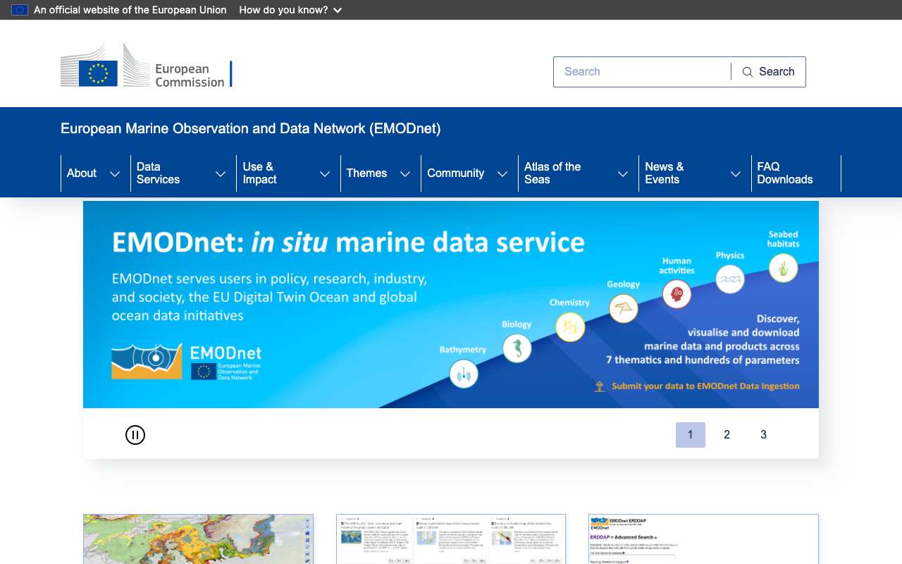
The European network for marine data in seven themes: bathymetry, geology, physics, chemistry, biology, seabed habitats and human activities. For the Dutch North Sea you'll find wind farms, cables, pipelines, vessel density, wrecks and depth, as map layers (WMS) and data (WFS).
Everything that's in it1,891
All layers from EMODnet's map and feature services, by theme, fetched every night. Geology and physics are missing: their servers disallow scripts in robots.txt.
Biologie (Biology)122
Chemie (Chemistry)1,106
Zeebodemleefgebieden (Seabed Habitats)438
Wind farm areas in the Dutch North Sea by status: planned is the largest part, 51% in October 2026
Breakdown in October 2026: planned 51%, in production 31%, under construction 13%, approved 5.1%. Total: 39 areas.
Offshore wind farms in production (Dutch North Sea) by capacity: most Hollandse Kust (Zuid) (1,540 megawatts), then Hollandse Kust (Noord) and Borssele Kavel IV
Offshore wind farms in production (Dutch North Sea) by capacity, October 2026, in megawatts. Total: 4,759; the largest 12 of 12 categories are shown. Hollandse Kust (Zuid) is 32% of the total. 12 parks with status "Production", 671 turbines in all. EMODnet updates the layer once a year (latest updateyear: 2026); a park that just opened may still be listed as under construction.
What can you do with it?4 ideas
Wind farms in the Dutch North Sea
According to EMODnet, 12 offshore wind farms are operating in the Netherlands with a combined 4,758.5 MW and 671 turbines. Five farms (3,556 MW) are under construction and twenty are planned (wind farm layer, metadata dated July 2026).
How deep is it here?
One call gives the depth at a point. At 4.0° east, 52.6° north (off the coast of North Holland) the average is 26.5 metres.
Shipping traffic next to the wind farms
Overlay the vessel density layer on the wind farms and cables. Where do shipping routes cross planned farms?
Distance to the coast
Every wind farm has a dist_coast field in metres. Compare the Dutch farms with those of Germany, Denmark and the United Kingdom.
How to process it4 steps
Pick the right theme portal
Each theme has its own server, e.g. ows.emodnet-humanactivities.eu (wind farms, cables, shipping) and ows.emodnet-bathymetry.eu (depth). The documentation lists all WMS, WFS and WCS addresses.
https://emodnet.ec.europa.eu/en/emodnet-web-service-documentation
View the layers
Human Activities' WFS lists 161 layers (the WMS 208, 16 Oct 2026), from wind farms (emodnet:windfarmspoly) to Rijkswaterstaat cables (emodnet:pcablesrijks).
https://ows.emodnet-humanactivities.eu/wfs?service=WFS&request=GetCapabilities&version=2.0.0
Filter on the Netherlands
GeoServer supports CQL_FILTER: country='Netherlands'. Use propertyName to pick fields; outputFormat=csv or application/json.
https://ows.emodnet-humanactivities.eu/wfs?service=WFS&version=2.0.0&request=GetFeature&typeNames=emodnet:windfarmspoly&outputFormat=csv&CQL_FILTER=country='Netherlands'&propertyName=name,status,power_mw,n_turbines,year
Depth at a point
The Bathymetry REST service returns minimum, maximum and average depth (in metres, negative = below sea level) and the source of the measurement.
https://rest.emodnet-bathymetry.eu/depth_sample?geom=POINT(4.0%2052.6)
Interesting combinations

Similar sources
- NNoordzeeloket (Rijksoverheid) not in the index yet
The Dutch government's portal for the North Sea, with the North Sea Programme and offshore wind energy. Plans and decisions, but no European data layers.
 Copernicus Sentinel-2
Satellite images of sea and coast; no depth, cables or permits.
What to watch out for
- Status lags behind reality
The wind farm layer is updated once a year (field updateyear). A farm that just opened may still say 'Construction'. Check recent farms with Noordzeeloket or the operator.
- EMODnet aggregates, it does not create
The data come from national institutes. The licence is CC BY 4.0 unless stated otherwise, but read the metadata of the original source and credit it.
- A different server per theme
Bathymetry, Human Activities, Geology and the other themes each have their own address, layers and naming. Start at the documentation page.
- Depth is an average per cell
The depth grid has cells of about 125 metres. For navigation or construction use the official nautical charts.
APIOGC WFS 2.0.0 · read 16 Oct 2026
No key. Fees: NONE; access constraints: NONE. from the description
features in emodnet:windfarmspoly tested
application/gml+xml; version=3.2GML2SHAPE-ZIPapplication/jsoncsvgml3gml32jsontext/csvtext/xml; subtype=gml/2.1.2text/xml; subtype=gml/3.1.1text/xml; subtype=gml/3.2
Base URL
https://ows.emodnet-humanactivities.eu/wfs
Endpoints 11
- GET
?request=GetCapabilitiesservice description - GET
?request=DescribeFeatureTypefields of a layer (XSD) - GET
?request=GetFeaturethe features themselves, with geometry - GET
?request=GetPropertyValueonly the values of one field - GET
?request=ListStoredQueriesstored queries - GET
?request=DescribeStoredQueriesstored query details - GET
?request=CreateStoredQueryCreateStoredQuery - GET
?request=DropStoredQueryDropStoredQuery - GET
?request=LockFeatureLockFeature - GET
?request=GetFeatureWithLockGetFeatureWithLock - GET
?request=TransactionTransaction
Layers and projections
- Active Licences
emodnet:activelicensesEPSG:4326 - Advisory Councils
emodnet:advisorycouncilsEPSG:4326 - Advisory Councils (Pelagic Stocks)
emodnet:pelagicstocksEPSG:4326 - Advisory Councils (Aquaculture)
emodnet:aquacultureEPSG:4326 - Advisory Councils (Baltic)
emodnet:balticEPSG:4326 - Advisory Councils (Black Sea)
emodnet:blackseaEPSG:4326 - Advisory Councils (Long Distance Fleet)
emodnet:longdistancefleetEPSG:4326 - Advisory Councils (Market)
emodnet:marketEPSG:4326 - Advisory Councils (Mediterranean)
emodnet:mediterraneanEPSG:4326 - Advisory Councils (North Sea)
emodnet:northseaEPSG:4326 - Advisory Councils (North-western Waters)
emodnet:northwesternwatersEPSG:4326 - Advisory Councils (Outermost Regions)
emodnet:outermostregionsEPSG:4326 - Advisory Councils (South-western Waters)
emodnet:southwesternwatersEPSG:4326 - Aggregate Extraction Areas
emodnet:aggregateareasEPSG:4326 - Aggregate Extraction Locations
emodnet:aggregatesEPSG:4326 - Average MW Fishing hours: Beam trawls
emodnet:fishingbeamtrawlsEPSG:4326 - Average MW Fishing hours: Bottom otter trawls
emodnet:fishingbottomottertrawlsEPSG:4326 - Average MW Fishing hours: Bottom seines
emodnet:fishingbottomseinesEPSG:4326 - Average MW Fishing hours: Dredges
emodnet:fishingdredgesEPSG:4326 - Average MW Fishing hours: Pelagic trawls and seines
emodnet:fishingpelagicEPSG:4326 - Average MW Fishing hours: Static gears
emodnet:fishingstaticgearsEPSG:4326 - Average Subsurface Swept Area Ratio
emodnet:fishingsubsurfaceEPSG:4326 - Average Surface Swept Area Ratio
emodnet:fishingsurfaceEPSG:4326 - Barcelona Convention
emodnet:barcelonaEPSG:4326 - Boreholes
emodnet:hydrocarbonsEPSG:4326 - Bucharest Convention
emodnet:bucharestEPSG:4326 - Desalination Plants
emodnet:desalinationEPSG:4326 - Discharge Points
emodnet:dischargepointsEPSG:4326 - Dredge Spoil Dumping (Points)
emodnet:dredgespoilEPSG:4326 - Dredge Spoil Dumping (Polygons)
emodnet:dredgespoilpolyEPSG:4326 - Dredging
emodnet:dredgingEPSG:4326 - Dumped Munitions (Points)
emodnet:munitionsEPSG:4326 - Dumped Munitions (Polygons)
emodnet:munitionspolyEPSG:4326 - EMODnet Marinas
emodnet:emodnetmarinasEPSG:4326 - Emerald Network
emodnet:emeraldnetworkEPSG:4326 - FAO Statistical Areas
emodnet:faoareas_oldEPSG:4326 - FAO Statistical Areas for Fishery Purposes
emodnet:fao_areasEPSG:4326 - Finfish Production
emodnet:finfishEPSG:4326 - First Sales of Fish
emodnet:fishsalesEPSG:4326 - First Sales of Fish by Species
emodnet:fishsalesbyspeciesEPSG:4326 - Fish Catches by FAO Fishery Statistical Areas (Division Area)
emodnet:divisioncatchesEPSG:4326 - Fish Catches by FAO Fishery Statistical Areas (Major Area)
emodnet:majorcatchesEPSG:4326 - Fish Catches by FAO Fishery Statistical Areas (Sub-area Area)
emodnet:subareacatchesEPSG:4326 - Fish Catches by FAO Fishery Statistical Areas (Sub-division Area)
emodnet:subdivisioncatchesEPSG:4326 - Fish Catches by FAO Fishery Statistical Areas (Sub-unit Area)
emodnet:subunitcatchesEPSG:4326 - Fish Catches by FAO Fishery Statistical Areas and Commodity Group (Division Area)
emodnet:divisioncatchesbygroupEPSG:4326 - Fish Catches by FAO Fishery Statistical Areas and Commodity Group (Major Area)
emodnet:majorcatchesbygroupEPSG:4326 - Fish Catches by FAO Fishery Statistical Areas and Commodity Group (Sub-area Area)
emodnet:subareacatchesbygroupEPSG:4326 - Fish Catches by FAO Fishery Statistical Areas and Commodity Group (Sub-division Area)
emodnet:subdivisioncatchesbygroupEPSG:4326 - Fish Catches by FAO Fishery Statistical Areas and Commodity Group (Sub-unit Area)
emodnet:subunitcatchesbygroupEPSG:4326 - Fish Catches by FAO Fishery Statistical Areas and Country (Division Area)
emodnet:divisioncatchesbycountryEPSG:4326 - Fish Catches by FAO Fishery Statistical Areas and Country (Major Area)
emodnet:majorcatchesbycountryEPSG:4326 - Fish Catches by FAO Fishery Statistical Areas and Country (Sub-area Area)
emodnet:subareacatchesbycountryEPSG:4326 - Fish Catches by FAO Fishery Statistical Areas and Country (Sub-division Area)
emodnet:subdivisioncatchesbycountryEPSG:4326 - Fish Catches by FAO Fishery Statistical Areas and Country (Sub-unit Area)
emodnet:subunitcatchesbycountryEPSG:4326 - Fishing Effort by FAO Areas/GFCM Subareas (Division)
emodnet:divisioneffortEPSG:4326 - Fishing Effort by FAO Areas/GFCM Subareas (GFCM Sub-area)
emodnet:gfcmsubareaeffortEPSG:4326 - Fishing Effort by FAO Areas/GFCM Subareas (Major)
emodnet:majoreffortEPSG:4326 - Fishing Effort by FAO Areas/GFCM Subareas (Sub-area)
emodnet:subareaeffortEPSG:4326 - Fishing Effort by FAO Areas/GFCM Subareas (Sub-division)
emodnet:subdivisioneffortEPSG:4326 - Fishing Effort by FAO Areas/GFCM Subareas (Sub-unit)
emodnet:subuniteffortEPSG:4326 - Fishing Effort by FAO Areas/GFCM Subareas and Country (Division Area) Ver1
emodnet:divisioneffortbycountryv1EPSG:4326 - Fishing Effort by FAO Areas/GFCM Subareas and Country (Division)
emodnet:divisioneffortbycountryEPSG:4326 - Fishing Effort by FAO Areas/GFCM Subareas and Country (GFCM Sub-area)
emodnet:gfcmsubareaeffortbycountryEPSG:4326 - Fishing Effort by FAO Areas/GFCM Subareas and Country (GFCM Subarea) Ver 1
emodnet:gfcmsubareaeffortbycountryv1EPSG:4326 - Fishing Effort by FAO Areas/GFCM Subareas and Country (Major Area) Ver 1
emodnet:majoreffortbycountryv1EPSG:4326 - Fishing Effort by FAO Areas/GFCM Subareas and Country (Major)
emodnet:majoreffortbycountryEPSG:4326 - Fishing Effort by FAO Areas/GFCM Subareas and Country (Sub-area Area) Ver 1
emodnet:subareaeffortbycountryv1EPSG:4326 - Fishing Effort by FAO Areas/GFCM Subareas and Country (Sub-area)
emodnet:subareaeffortbycountryEPSG:4326 - Fishing Effort by FAO Areas/GFCM Subareas and Country (Sub-division Area) Ver 1
emodnet:subdivisioneffortbycountryv1EPSG:4326 - Fishing Effort by FAO Areas/GFCM Subareas and Country (Sub-division)
emodnet:subdivisioneffortbycountryEPSG:4326 - Fishing Effort by FAO Areas/GFCM Subareas and Country (Sub-unit Area) Ver1
emodnet:subuniteffortbycountryv1EPSG:4326 - Fishing Effort by FAO Areas/GFCM Subareas and Country (Sub-unit)
emodnet:subuniteffortbycountryEPSG:4326 - Fishing Effort by FAO Areas/GFCM Subareas and Vessel Type (Division Area) Ver 1
emodnet:divisioneffortbyvesseltypev1EPSG:4326 - Fishing Effort by FAO Areas/GFCM Subareas and Vessel Type (Division)
emodnet:divisioneffortbyvesseltypeEPSG:4326 - Fishing Effort by FAO Areas/GFCM Subareas and Vessel Type (GFCM Sub-area
emodnet:gfcmsubareaeffortbyvesseltypeEPSG:4326 - Fishing Effort by FAO Areas/GFCM Subareas and Vessel Type (GFCM Subarea) Ver 1
emodnet:gfcmsubareaeffortbyvesseltypev1EPSG:4326 - Fishing Effort by FAO Areas/GFCM Subareas and Vessel Type (Major Area) Ver 1
emodnet:majoreffortbyvesseltypev1EPSG:4326 - Fishing Effort by FAO Areas/GFCM Subareas and Vessel Type (Major)
emodnet:majoreffortbyvesseltypeEPSG:4326 - Fishing Effort by FAO Areas/GFCM Subareas and Vessel Type (Sub-area Area) Ver 1
emodnet:subareaeffortbyvesseltypev1EPSG:4326 - Fishing Effort by FAO Areas/GFCM Subareas and Vessel Type (Sub-area)
emodnet:subareaeffortbyvesseltypeEPSG:4326 - Fishing Effort by FAO Areas/GFCM Subareas and Vessel Type (Sub-division Area) Ver 1
emodnet:subdivisioneffortbyvesseltypev1EPSG:4326 - Fishing Effort by FAO Areas/GFCM Subareas and Vessel Type (Sub-division)
emodnet:subdivisioneffortbyvesseltypeEPSG:4326 - Fishing Effort by FAO Areas/GFCM Subareas and Vessel Type (Sub-unit Area) Ver 1
emodnet:subuniteffortbyvesseltypev1EPSG:4326 - Fishing Effort by FAO Areas/GFCM Subareas and Vessel Type (Sub-unit)
emodnet:subuniteffortbyvesseltypeEPSG:4326 - Fishing Effort by FAO Fishery Statistical Areas and GFCM Subareas (Division) Ver 1
emodnet:divisioneffortv1EPSG:4326 - Fishing Effort by FAO Fishery Statistical Areas and GFCM Subareas (GFCM Sub-area) Ver 1
emodnet:gfcmsubareaeffortv1EPSG:4326 - Fishing Effort by FAO Fishery Statistical Areas and GFCM Subareas (Major) Ver 1
emodnet:majoreffortv1EPSG:4326 - Fishing Effort by FAO Fishery Statistical Areas and GFCM Subareas (Sub-area) Ver1
emodnet:subareaeffortv1EPSG:4326 - Fishing Effort by FAO Fishery Statistical Areas and GFCM Subareas (Sub-division) Ver 1
emodnet:subdivisioneffortv1EPSG:4326 - Fishing Effort by FAO Fishery Statistical Areas and GFCM Subareas (Sub-unit) Ver 1
emodnet:subuniteffortv1EPSG:4326 - Fishing Quotas by FMZs
emodnet:fishquotasEPSG:4326 - Fishing Quotas by FMZs
emodnet:fishquotas240408EPSG:4326 - Fishing Quotas by FMZs and Level
emodnet:fishquotas240408bylevelEPSG:4326 - Fishing Quotas by FMZs and Level
emodnet:fishquotasbylevelEPSG:4326 - Fishing Quotas by FMZs and Species
emodnet:fishquotas240408byspeciesEPSG:4326 - Fishing Quotas by FMZs and Species
emodnet:fishquotasbyspeciesEPSG:4326 - Freshwater Production
emodnet:freshwaterEPSG:4326 - HELCOM Maritime Area
emodnet:helcomEPSG:4326 - Heritage Ship Wrecks
emodnet:heritageshipwrecksEPSG:4326 - ICES Statistical Areas
emodnet:icesareasEPSG:4326 - International Conventions
emodnet:intconventionsEPSG:4326 - Lighthouses
emodnet:lighthousesEPSG:4326 - MSFD Reporting Units
emodnet:reportingunitsEPSG:4326 - MSP Spatial Plan Areas
emodnet:mspspatialplanEPSG:4326 - MSP Zoning Areas by Function
emodnet:mspzoningpolybyusefunctionEPSG:4326 - MSP Zoning Areas by Planned Marine Use
emodnet:mspzoningpolyEPSG:4326 - MSP Zoning Lines by Function
emodnet:mspzoninglinebyusefunctionEPSG:4326 - MSP Zoning Lines by Planned Marine Use
emodnet:mspzoninglineEPSG:4326 - MSP Zoning Points by Function
emodnet:mspzoninglocsbyusefunctionEPSG:4326 - MSP Zoning Points by Planned Marine Use
emodnet:mspzoninglocsEPSG:4326 - Macroalgae (seaweeds)
emodnet:macroalgaeEPSG:4326 - Main Ports (Goods Traffic 1997-2025)
emodnet:portgoodsEPSG:4326 - Main Ports (Locations Only)
emodnet:portlocationsEPSG:4326 - Main Ports (Passengers Traffic 1997-2025)
emodnet:portpassengersEPSG:4326 - Main Ports (Vessles Traffic 1997-2025)
emodnet:portvesselsEPSG:4326 - Main Ports (Vessles Traffic by Tonnage 1997-2025)
emodnet:portvesselsbytonnageEPSG:4326 - Main Ports (Vessles Traffic by Type 1997-2025)
emodnet:portvesselsbytypeEPSG:4326 - Microalgae
emodnet:microalgaeEPSG:4326 - Military Areas (Points)
emodnet:militaryareasEPSG:4326 - Military Areas (Polygons)
emodnet:militaryareaspolyEPSG:4326 - Nationally Designated Areas
emodnet:cddaareasEPSG:4326 - Nationally Designated Areas (Locations)
emodnet:cddalocationsEPSG:4326 - Nationally Designated Areas (Points)
emodnet:nationallydesignatedlocsEPSG:4326 - Nationally Designated Areas (Polygons)
emodnet:nationallydesignatedareasEPSG:4326 - Natura 2000
emodnet:natura2000areasEPSG:4326 - Nuclear Power Plants
emodnet:nuclearEPSG:4326 - Number of nights spent by municipality (LAU)
emodnet:tourismlauEPSG:4326 - OSPAR Maritime Area
emodnet:osparEPSG:4326 - Ocean Energy - Project Locations
emodnet:oenergyEPSG:4326 - Ocean Energy - Test Sites
emodnet:oenergytestsEPSG:4326 - Offshore Installations
emodnet:platformsEPSG:4326 - OpenStreetMap Marinas (areas)
emodnet:osmmarinaspolyEPSG:4326 - OpenStreetMap Marinas (points)
emodnet:osmmarinasEPSG:4326 - Pipelines
emodnet:pipelinesEPSG:4326 - Power Cables - DE BSH-CONTIS
emodnet:pcablesbshcontisEPSG:4326 - Power Cables - FR SHOM
emodnet:pcablesshomEPSG:4326 - Power Cables - NL Rijkswaterstaat
emodnet:pcablesrijksEPSG:4326 - Power Cables - NO NVE
emodnet:pcablesnveEPSG:4326 - Regional Sea Conventions MPAs
emodnet:marineprotectedareasEPSG:4326 - Shellfish Aquaculture Licensed Sites
emodnet:shellfishlicsEPSG:4236 - Shellfish Production
emodnet:shellfishEPSG:4326 - Shellfish Protected Areas under the WFD
emodnet:shellfishwfdareasEPSG:4326 - Spirulina
emodnet:spirulinaEPSG:4326 - State of Bathing Waters
emodnet:bathingwatersEPSG:4326 - Telecommunication Cables - DE BSH-CONTIS
emodnet:bshcontiscablesEPSG:4326 - Telecommunication Cables - ES CICA
emodnet:cicacablesEPSG:4326 - Telecommunication Cables - FR SHOM
emodnet:shomcablesEPSG:4326 - Telecommunication Cables - FR SIGCables
emodnet:sigcablesEPSG:4326 - Telecommunication Cables - MT IOI-MOC
emodnet:maltacablesEPSG:4326 - Telecommunication Cables - NL Rijkswaterstaat
emodnet:rijkscablesEPSG:4326 - Telecommunication Cables - UK OGA
emodnet:ukfibrecablesEPSG:4326 - Tourism ecosystem indicators by NUTS3 region
emodnet:tourismnuts3EPSG:4326 - Treatment Plants
emodnet:treatmentplantsEPSG:4326 - UNESCO World Heritage Convention
emodnet:unescowhlEPSG:4326 - Waste at Ports (m3/tonnes)
emodnet:wasteatportsEPSG:4326 - Wind Farms (Points)
emodnet:windfarmsEPSG:4326 - Wind Farms (Polygons)
emodnet:windfarmspolyEPSG:4326 - World Database on Protected Areas
emodnet:wdpaareasEPSG:4326 - World Database on Protected Areas (Locations)
emodnet:wdpalocationsEPSG:4326 - Worldwide wreck locations (UK Hydrographic Office)
emodnet:wwshipwrecksEPSG:4326
Filtering from the description
OGC Filter Encoding (FES 2.0)
Parameters 6
typeNames | which layer: emodnet:activelicenses, emodnet:advisorycouncils, emodnet:pelagicstocks, emodnet:aquaculture, emodnet:baltic, emodnet:blacksea, emodnet:longdistancefleet, emodnet:market, emodnet:mediterranean, emodnet:northsea, emodnet:northwesternwaters, emodnet:outermostregions, emodnet:southwesternwaters, emodnet:aggregateareas, emodnet:aggregates, emodnet:fishingbeamtrawls, emodnet:fishingbottomottertrawls, emodnet:fishingbottomseines, emodnet:fishingdredges, emodnet:fishingpelagic, emodnet:fishingstaticgears, emodnet:fishingsubsurface, emodnet:fishingsurface, emodnet:barcelona, emodnet:hydrocarbons, emodnet:bucharest, emodnet:desalination, emodnet:dischargepoints, emodnet:dredgespoil, emodnet:dredgespoilpoly, emodnet:dredging, emodnet:munitions, emodnet:munitionspoly, emodnet:emodnetmarinas, emodnet:emeraldnetwork, emodnet:faoareas_old, emodnet:fao_areas, emodnet:finfish, emodnet:fishsales, emodnet:fishsalesbyspecies, emodnet:divisioncatches, emodnet:majorcatches, emodnet:subareacatches, emodnet:subdivisioncatches, emodnet:subunitcatches, emodnet:divisioncatchesbygroup, emodnet:majorcatchesbygroup, emodnet:subareacatchesbygroup, emodnet:subdivisioncatchesbygroup, emodnet:subunitcatchesbygroup, emodnet:divisioncatchesbycountry, emodnet:majorcatchesbycountry, emodnet:subareacatchesbycountry, emodnet:subdivisioncatchesbycountry, emodnet:subunitcatchesbycountry, emodnet:divisioneffort, emodnet:gfcmsubareaeffort, emodnet:majoreffort, emodnet:subareaeffort, emodnet:subdivisioneffort, emodnet:subuniteffort, emodnet:divisioneffortbycountryv1, emodnet:divisioneffortbycountry, emodnet:gfcmsubareaeffortbycountry, emodnet:gfcmsubareaeffortbycountryv1, emodnet:majoreffortbycountryv1, emodnet:majoreffortbycountry, emodnet:subareaeffortbycountryv1, emodnet:subareaeffortbycountry, emodnet:subdivisioneffortbycountryv1, emodnet:subdivisioneffortbycountry, emodnet:subuniteffortbycountryv1, emodnet:subuniteffortbycountry, emodnet:divisioneffortbyvesseltypev1, emodnet:divisioneffortbyvesseltype, emodnet:gfcmsubareaeffortbyvesseltype, emodnet:gfcmsubareaeffortbyvesseltypev1, emodnet:majoreffortbyvesseltypev1, emodnet:majoreffortbyvesseltype, emodnet:subareaeffortbyvesseltypev1, emodnet:subareaeffortbyvesseltype, emodnet:subdivisioneffortbyvesseltypev1, emodnet:subdivisioneffortbyvesseltype, emodnet:subuniteffortbyvesseltypev1, emodnet:subuniteffortbyvesseltype, emodnet:divisioneffortv1, emodnet:gfcmsubareaeffortv1, emodnet:majoreffortv1, emodnet:subareaeffortv1, emodnet:subdivisioneffortv1, emodnet:subuniteffortv1, emodnet:fishquotas, emodnet:fishquotas240408, emodnet:fishquotas240408bylevel, emodnet:fishquotasbylevel, emodnet:fishquotas240408byspecies, emodnet:fishquotasbyspecies, emodnet:freshwater, emodnet:helcom, emodnet:heritageshipwrecks, emodnet:icesareas, emodnet:intconventions, emodnet:lighthouses, emodnet:reportingunits, emodnet:mspspatialplan, emodnet:mspzoningpolybyusefunction, emodnet:mspzoningpoly, emodnet:mspzoninglinebyusefunction, emodnet:mspzoningline, emodnet:mspzoninglocsbyusefunction, emodnet:mspzoninglocs, emodnet:macroalgae, emodnet:portgoods, emodnet:portlocations, emodnet:portpassengers, emodnet:portvessels, emodnet:portvesselsbytonnage, emodnet:portvesselsbytype, emodnet:microalgae, emodnet:militaryareas, emodnet:militaryareaspoly, emodnet:cddaareas, emodnet:cddalocations, emodnet:nationallydesignatedlocs, emodnet:nationallydesignatedareas, emodnet:natura2000areas, emodnet:nuclear, emodnet:tourismlau, emodnet:ospar, emodnet:oenergy, emodnet:oenergytests, emodnet:platforms, emodnet:osmmarinaspoly, emodnet:osmmarinas, emodnet:pipelines, emodnet:pcablesbshcontis, emodnet:pcablesshom, emodnet:pcablesrijks, emodnet:pcablesnve, emodnet:marineprotectedareas, emodnet:shellfishlics, emodnet:shellfish, emodnet:shellfishwfdareas, emodnet:spirulina, emodnet:bathingwaters, emodnet:bshcontiscables, emodnet:cicacables, emodnet:shomcables, emodnet:sigcables, emodnet:maltacables, emodnet:rijkscables, emodnet:ukfibrecables, emodnet:tourismnuts3, emodnet:treatmentplants, emodnet:unescowhl, emodnet:wasteatports, emodnet:windfarms, emodnet:windfarmspoly, emodnet:wdpaareas, emodnet:wdpalocations, emodnet:wwshipwrecks | from the description |
outputFormat | e.g. application/json for GeoJSON | from the description |
srsName | projection, e.g. EPSG:4326 for web maps (default EPSG:4326) | from the description |
count / startIndex | paging | from the description |
filter | FES XML filter on fields or geometry | from the description |
bbox | box in the chosen projection | platform |
Fields 13 · emodnet:windfarmspoly
| Name | Type | Meaning |
|---|---|---|
country | string | |
n_turbines | int | |
power_mw | decimal | |
status | string | |
type_inst | string | |
updateyear | string | |
year | string | |
dist_coast | decimal | |
area_sqkm | decimal | |
notes | string | |
shape_leng | decimal | |
shape_area | decimal |
Show all 13
| Name | Type | Meaning |
|---|---|---|
the_geom | geometrie |
Limits and pitfalls
- At most 1,000,000 features per request (CountDefault). from the description
- Paging supported: count and startIndex (ImplementsResultPaging). from the description
- The whole wind farm layer (600 features in Europe) comes in one request; no paging needed for this layer. tested
- Filtering is easiest with the GeoServer parameter CQL_FILTER, e.g. country='Netherlands' AND status='Production' (12 farms, 15 Oct 2026). tested
- With propertyName without the_geom you get geometry: null: useful when you only want the table. tested
- outputFormat=csv also works and returns an FID column plus the chosen fields. tested
- dist_coast is in metres, power_mw in megawatts. Statuses: Production, Construction, Approved, Planned (and in other countries also Dismantled and Test site). from the description
Try it HTTP 200 · 259 ms · 16 Oct
https://ows.emodnet-humanactivities.eu/wfs?service=WFS&version=2.0.0&request=GetFeature&typeNames=emodnet:windfarmspoly&outputFormat=application/json&count=2&CQL_FILTER=country='Netherlands' AND status='Production'&propertyName=name,status,power_mw,n_turbines,year
{
  "type": "FeatureCollection",
  "features": [
    {
      "type": "Feature",
      "id": "windfarmspoly.80",
      "geometry": null,
      "properties": {
        "name": "Borssele Kavel V",
        "n_turbines": 2,
        "power_mw": 19,
        "status": "Production",
        "year": "2020"
      }
    },
    {
      "type": "Feature",
      "id": "windfarmspoly.221",
      "geometry": null,
      "properties": {
        "name": "Buitengaats / Gemini I",
        "n_turbines": 75,
        "power_mw": 300,
        "status": "Production",
        "year": "2016"
      }
    }
  ],
  "totalFeatures": 12,
  "numberMatched": 12,
  "numberReturned": 2,
  "timeStamp": "2026-10-16T06:03:37.864Z",
  "crs": null
}
Shortened response, saved at harvest time. Click the URL for the real, current response.
Read from GetCapabilities: layers, projections, formats, filters, limit · DescribeFeatureType: fields of emodnet:windfarmspoly. Labels: from the description stated in what the api itself publishes. tested from our own small call. platform applies to every api on this platform, per its documentation. experience learned while building open data index.
How to fetch it
curl "https://ows.emodnet-humanactivities.eu/wfs?service=WFS&version=2.0.0&request=GetFeature&typeNames=emodnet:windfarmspoly&outputFormat=csv&CQL_FILTER=country='Netherlands'&propertyName=name,status,power_mw,n_turbines,year"
More from EMODnet in our index
1,891 datasets in EMODnet. These changed most recently.
- Natura 20002020-01-31
- [FI004005] Potential spawning areas for herring (PBS EFH)2018-10-29
- State of Bathing Waters2006-02-15
- [FI004008] Potential recruitment areas for pikeperch (PBS EFH)2001-11-29
- [FI004007] Potential recruitment areas for perch (PBS EFH)2001-11-29
- [FI004002] Potential spawning areas for Baltic flounder (PBS EFH)2001-11-29
More in this topic

See how this page is built
bron: emodnet
blokken: []
secties:
  - ideeen
  - verwerken
  - koppelingen
  - vergelijkbaar
  - beperkingen
  - code
cache:
  tag: bron:emodnet
  ververs: na statuscheck, als de bron nieuwer is
statuscheck:
  methode: dateStamp van het metadatarecord van de laag windparken
  verwacht: jaarlijks
Source: content/bronnen/emodnet.yaml · Markdown