What you can build with open data
30 projects to start with, from a train delay dashboard to a tracker of government money. Every project gives the real API calls, a prompt for Claude, ChatGPT or Cursor, and a script we ran ourselves. Together they use 59 sources from the index.
1–4 / 30
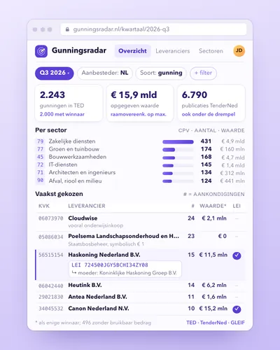 MockupDashboardProcurement radar: who wins public contracts?See per quarter which companies win Dutch public contracts, in which sector and for what amount, with their company number, LEI and parent company.


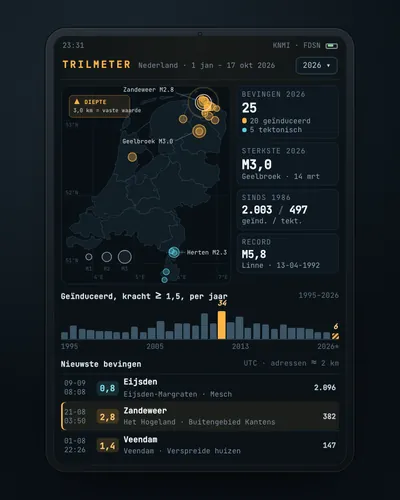 MockupMapEarthquake tracker: every quake on the map, with municipality and homesA map and timeline of every earthquake in the Netherlands since 1986, with magnitude, type, municipality and neighbourhood, and the number of addresses within two kilometres of the epicentre.


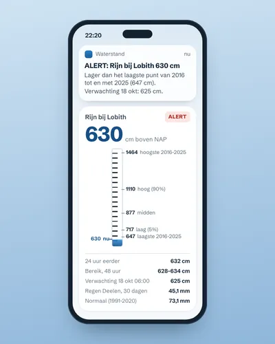 MockupAlertAlert when the river near you is too high or too lowA small script that fetches the Rijkswaterstaat water level every few hours, adds the forecast for the coming days and sends an alert when the river leaves the normal band of the past ten years. With KNMI rainfall as context.
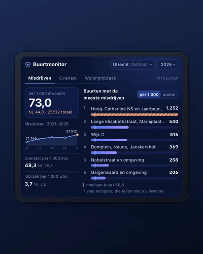 MockupDashboardNeighbourhood safety monitor: nuisance and crime per neighbourhoodA dashboard that shows, for every neighbourhood in your municipality, how much nuisance and crime the police record, per 1,000 residents and over the years, with a map and a comparison with the whole of the Netherlands.


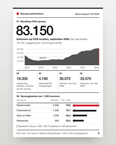 MockupDashboardAsylum reception dashboard: national and per municipalityA dashboard that shows how many people live in COA reception since 2016, how many arrive and leave, and how many reception places each municipality has, also per 1,000 residents.C
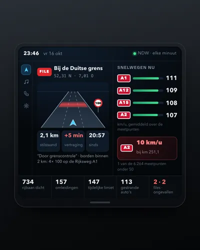 MockupDashboardDashboard of traffic jams, speeds and roadworksA dashboard showing every minute how fast traffic moves on the motorways, where it is at a standstill and which roads are closed, from NDW's open files, with the speed limit from the signs on site.

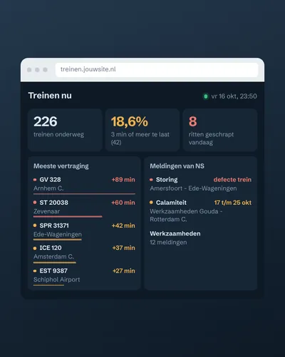 MockupDashboardTrain delay and disruption dashboardA page that shows every minute how many trains are running, which ones are late and which disruptions are going on, built on the open GTFS-Realtime file from openOV and, with a free key, the NS disruptions.N

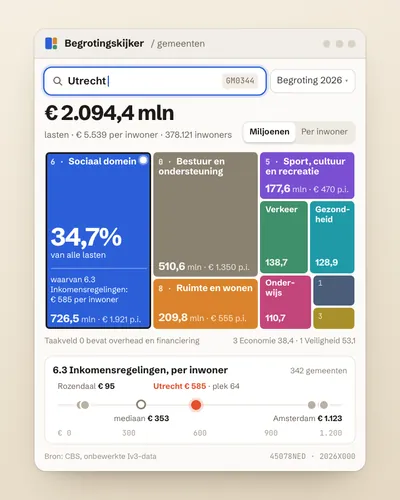 MockupToolMunicipal budget explorer: what does my municipality spend money on?Pick a municipality and see its budget per policy area, in euros per resident, and how one policy area compares with all 342 municipalities.
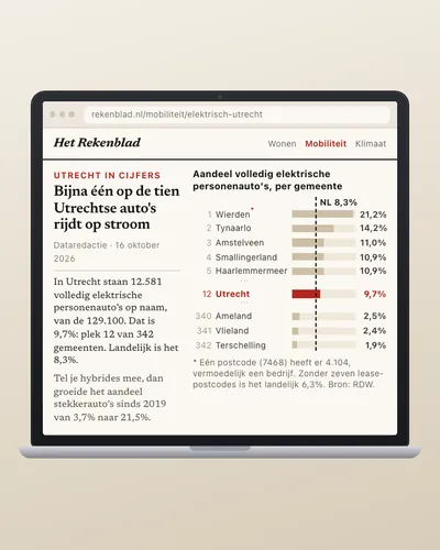 MockupAnalysisHow fast is your municipality going electric?A page showing per municipality what share of passenger cars is fully electric, where it ranks among the 342, and how fast it is going nationally, from the daily RDW count per postcode and the CBS annual series.

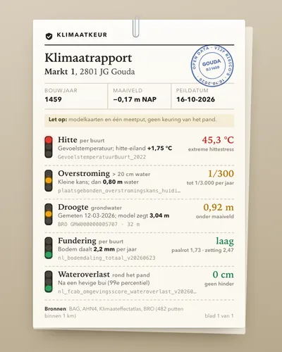 MockupToolClimate risk check for an addressType a postcode and house number and get one report on how the building fares on heat, flooding from rain, flooding from rivers and sea, drought and foundation problems, using the Klimaateffectatlas maps, the AHN elevation model, the BAG and real groundwater measurements from the BRO.



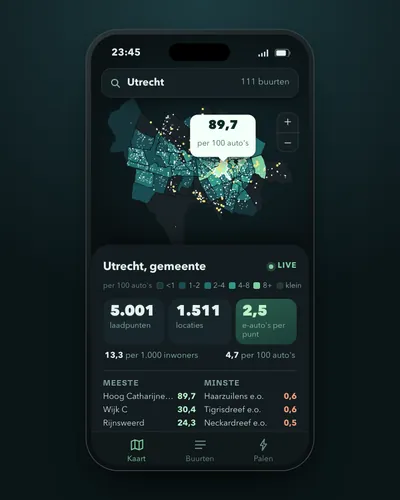 MockupMapCharging points per neighbourhood and per electric carA map of your municipality showing, per neighbourhood, how many public charging points there are, per 1,000 residents and per 100 cars, and how many electric cars depend on one charging point.
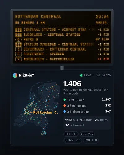 MockupMapLive map of buses, trams and metrosA map on which every bus, tram and metro in the Netherlands moves live, coloured by delay, from one open 180 kB file and without a key.
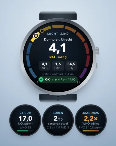 MockupAlertAir quality alert for your own streetA notification on your phone when the air at home is bad or about to get bad, based on the Luchtmeetnet forecast, the monitoring stations in your city, neighbours' sensors and the RIVM annual map.

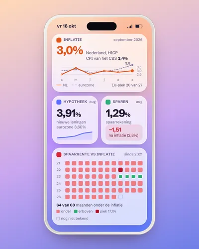 MockupDashboardMonitor for inflation, mortgage rates and savings ratesOne dashboard that shows every month how fast prices rise, what a new mortgage costs and what savings earn, in the Netherlands and the euro area.
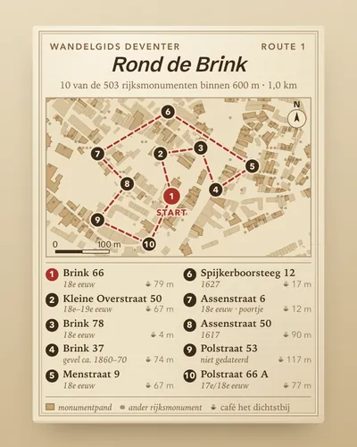 MockupAppA monument walk through your own neighbourhoodAn app that builds a walk past ten listed monuments around any starting point, with address, description, photo, a historic image from the Rijksmuseum and a café on the way.

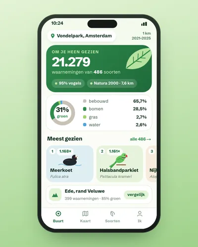 MockupAppNature in your neighbourhood: which species were seen and how green is it?An app that shows, for any point in the Netherlands, which plants and animals were observed within 1 km, how much of the land is green and how far away the nearest Natura 2000 site is.


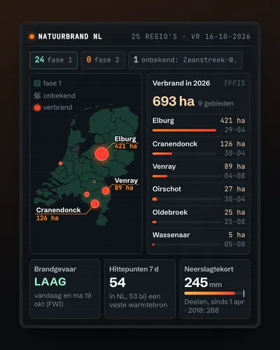 MockupMapWildfire map: today's risk, hotspots and burnt landOne map of the Netherlands per safety region with the fire service's phase, the fire danger for today and the coming days (EFFIS), the hotspots satellites saw this week (without factories) and the land that burnt this year, with KNMI drought data alongside.B


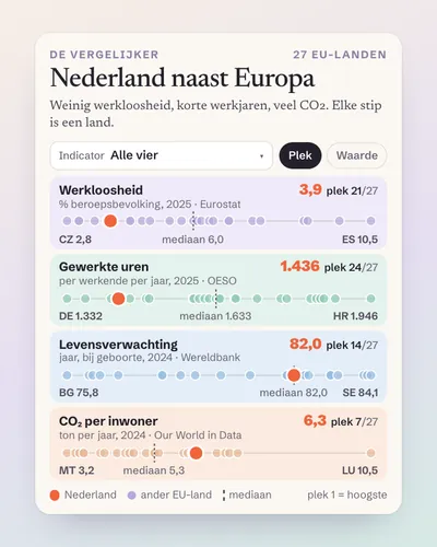 MockupToolThe Netherlands next to Europe: a comparison tool for any indicatorPick a figure (unemployment, hours worked, life expectancy, CO2) and see at once where the Netherlands ranks among the 27 EU countries, with four international sources behind one button.



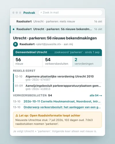 MockupAlertCouncil decision alert: a ping when your municipality decides somethingA script that searches your municipality's official announcements for your topic every day, reports only what is new, and adds what the council discussed about it earlier.

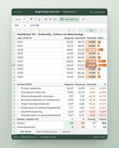 MockupDashboardNational budget tracker: budgeted against spentTrack per ministry and per budget article what central government planned to spend and what it actually spent, year after year, with the motions and amendments the House filed on it.

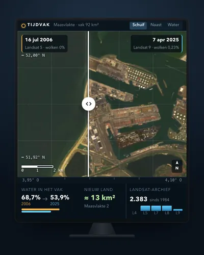 MockupToolSatellite before and after: see how your town or polder changedPick a place and two years, and get two cloud-free satellite images side by side with a slider, plus a calculation of how much water became land.

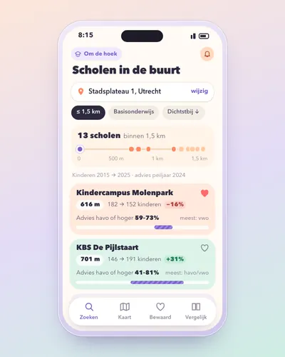 MockupToolSchool finder: primary schools around your address, with pupil numbers and school adviceType a postcode and house number and see every primary school within a radius, sorted by distance, with their pupil numbers over the years and what share of the children got a havo or vwo advice. Only open data from DUO and the BAG.
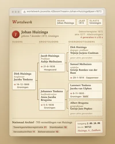 MockupAppFamily tree finder: from one record to your great-grandparentsStart with a birth record and let the app search back generation by generation through the marriage records of hundreds of Dutch archives, with a link to the National Archives inventory.


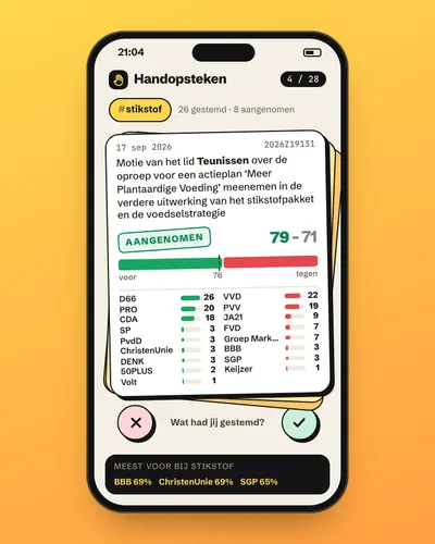 MockupAppVoting tracker: how did each party vote?Search a topic and see how each party in the House of Representatives voted on the motions about it: how often for, how often against, and which motions passed.
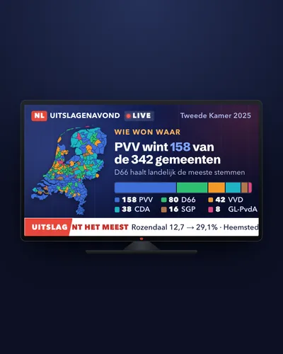 MockupMapElection map: result, shift and turnout per municipalityA map of all 342 municipalities with the largest party, the gain or loss since the previous election and the turnout, next to income per resident.

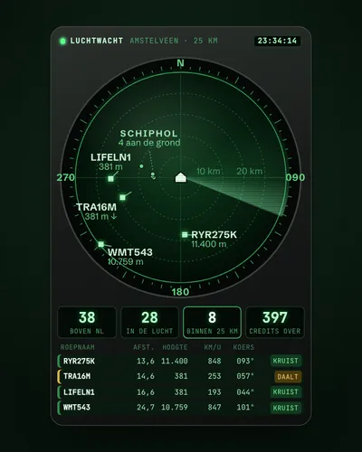 MockupAppWhat is flying over my house right now?A small app that shows every few minutes which aircraft are within 25 km of your address, how high, how fast and whether they are climbing or descending, using OpenSky's live positions and without an account.


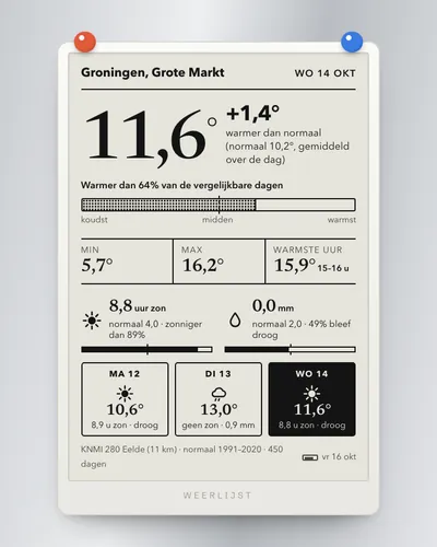 MockupAppWeather app for your own place: warmer, wetter or sunnier than normal?A small app that picks the nearest KNMI station and tells you how the latest day compares with the same time of year in 1991-2020: in degrees, millimetres and hours of sunshine, and as a percentile.
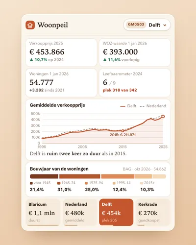 MockupDashboardHousing market dashboard for your municipalityOne page per municipality with sale prices, WOZ value, housing stock, construction years, dwelling size and liveability, next to the national average. All from open APIs without a key.
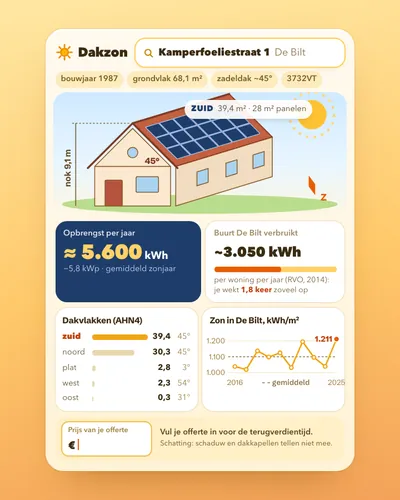 MockupToolSolar panel check for your own roofType a postcode and house number and see how large your roof surfaces are, which way they face, how much sun falls on them and roughly what panels would yield, using open data from BAG, AHN, KNMI and RVO.
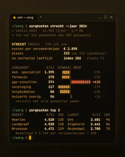 MockupToolHealthcare cost comparer per municipalityA tool that shows what basic health insurance spends per resident in your municipality, per type of care, and how that compares with the rest of the Netherlands, also after correcting for age.


Databron
Build any project below with your own AI
Databron is a free upgrade for your AI assistant. It finds the right source in this index, fetches and checks the numbers, and publishes a website that updates every day, with the source next to every number.
In Claude Code, two separate steps (press Enter after each)
/plugin marketplace add lucashuizinga/databron-skill
/plugin install databron@databron
Or in one go in your terminal:
claude plugin marketplace add lucashuizinga/databron-skill && claude plugin install databron@databron
Also for Codex, Cursor, Copilot and Gemini CLI. Then, in an empty folder:
/databron Is it warmer than normal in De Bilt this year?
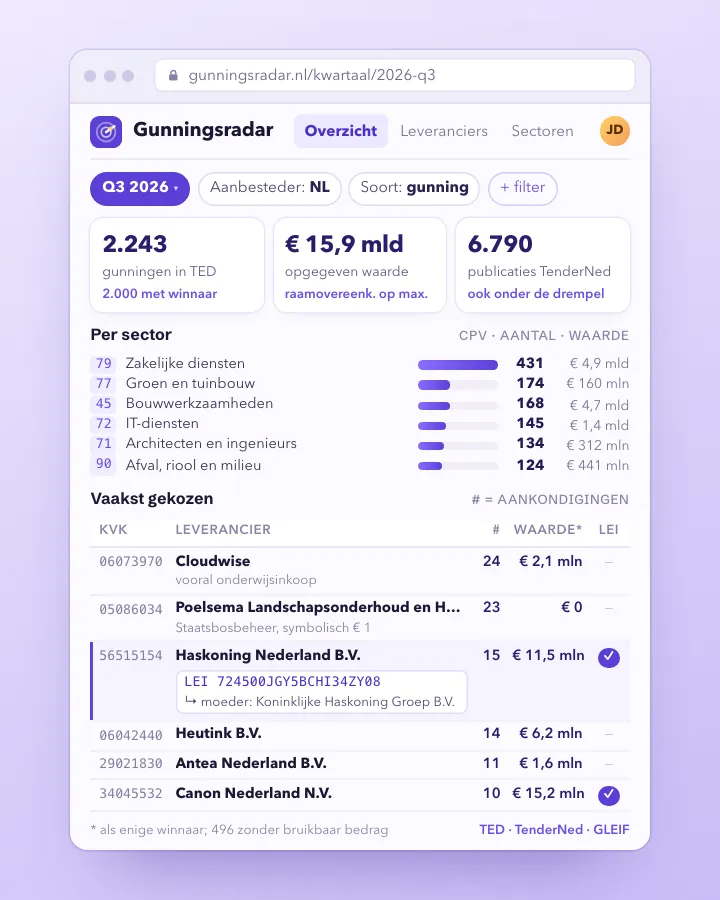 DashboardProcurement radar: who wins public contracts?See per quarter which companies win Dutch public contracts, in which sector and for what amount, with their company number, LEI and parent company.Advanced
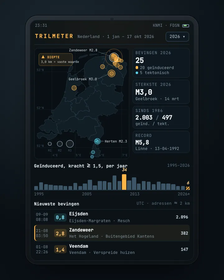 MapEarthquake tracker: every quake on the map, with municipality and homesA map and timeline of every earthquake in the Netherlands since 1986, with magnitude, type, municipality and neighbourhood, and the number of addresses within two kilometres of the epicentre.Getting started
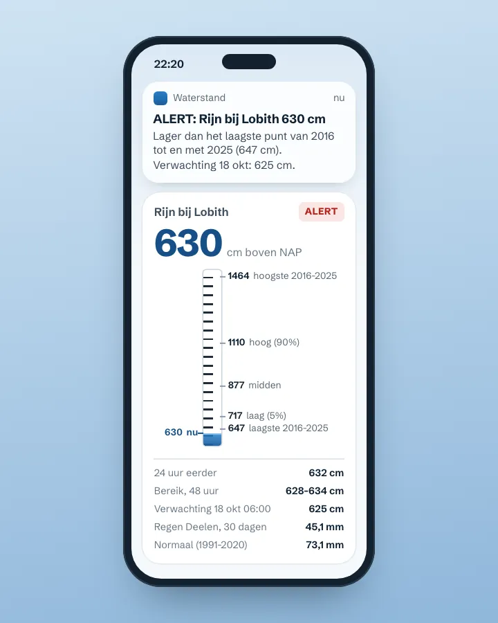 AlertAlert when the river near you is too high or too lowA small script that fetches the Rijkswaterstaat water level every few hours, adds the forecast for the coming days and sends an alert when the river leaves the normal band of the past ten years. With KNMI rainfall as context.Getting started
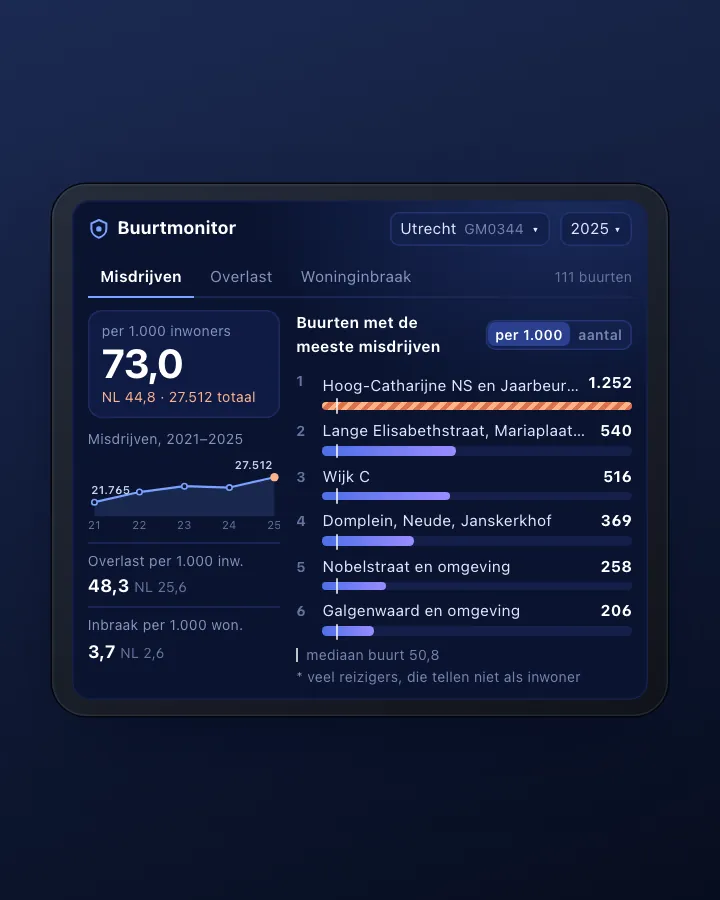 DashboardNeighbourhood safety monitor: nuisance and crime per neighbourhoodA dashboard that shows, for every neighbourhood in your municipality, how much nuisance and crime the police record, per 1,000 residents and over the years, with a map and a comparison with the whole of the Netherlands.Advanced
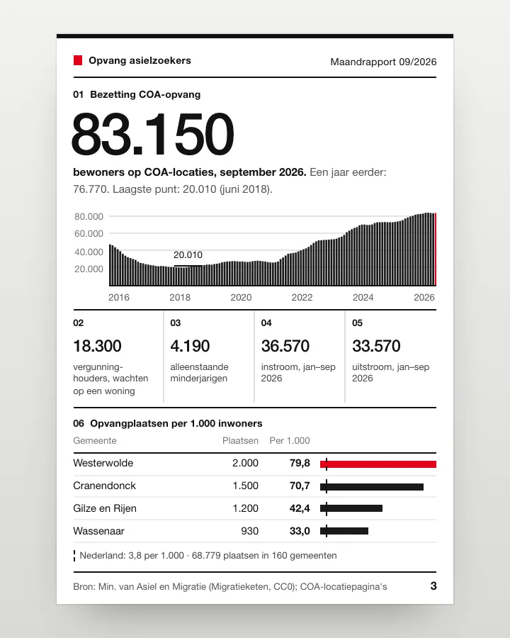 DashboardAsylum reception dashboard: national and per municipalityA dashboard that shows how many people live in COA reception since 2016, how many arrive and leave, and how many reception places each municipality has, also per 1,000 residents.CGetting started
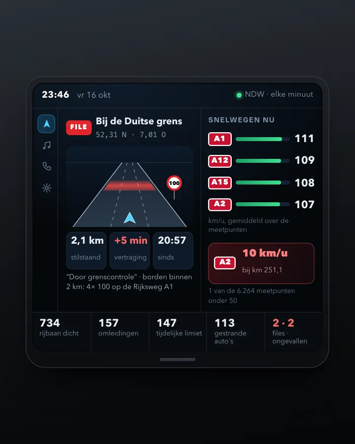 DashboardDashboard of traffic jams, speeds and roadworksA dashboard showing every minute how fast traffic moves on the motorways, where it is at a standstill and which roads are closed, from NDW's open files, with the speed limit from the signs on site.Advanced
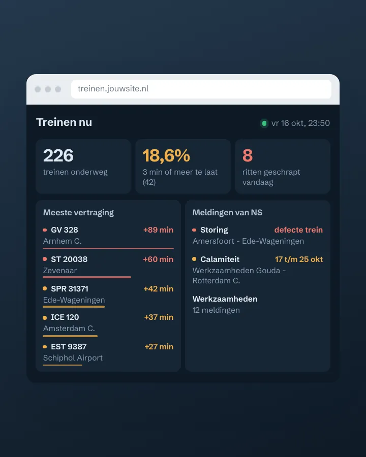 DashboardTrain delay and disruption dashboardA page that shows every minute how many trains are running, which ones are late and which disruptions are going on, built on the open GTFS-Realtime file from openOV and, with a free key, the NS disruptions.NGetting started
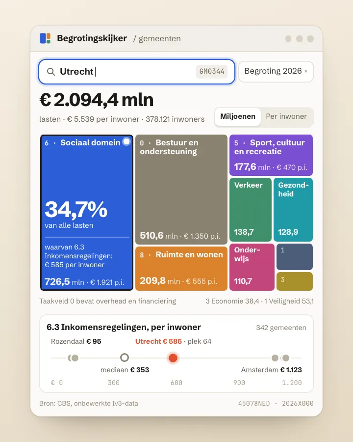 ToolMunicipal budget explorer: what does my municipality spend money on?Pick a municipality and see its budget per policy area, in euros per resident, and how one policy area compares with all 342 municipalities.Advanced
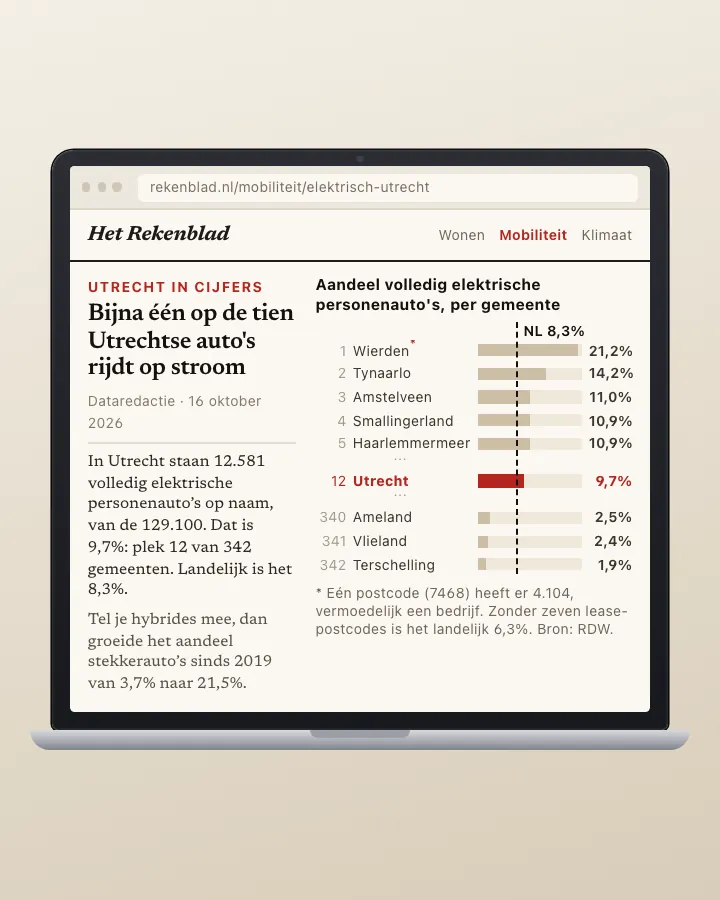 AnalysisHow fast is your municipality going electric?A page showing per municipality what share of passenger cars is fully electric, where it ranks among the 342, and how fast it is going nationally, from the daily RDW count per postcode and the CBS annual series.Getting started
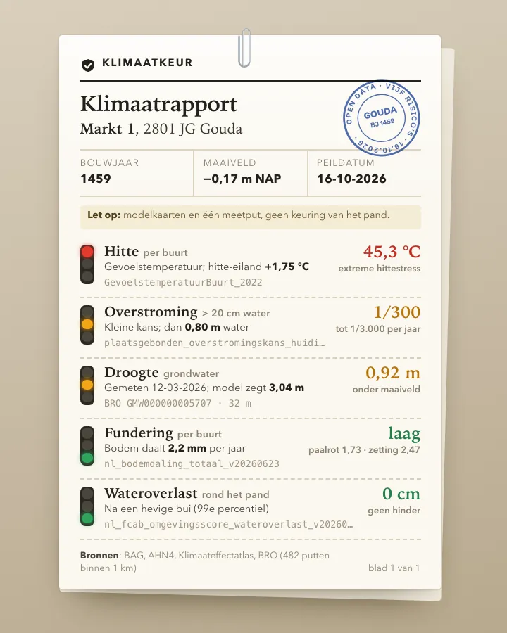 ToolClimate risk check for an addressType a postcode and house number and get one report on how the building fares on heat, flooding from rain, flooding from rivers and sea, drought and foundation problems, using the Klimaateffectatlas maps, the AHN elevation model, the BAG and real groundwater measurements from the BRO.Advanced
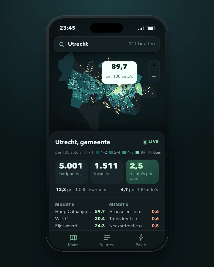 MapCharging points per neighbourhood and per electric carA map of your municipality showing, per neighbourhood, how many public charging points there are, per 1,000 residents and per 100 cars, and how many electric cars depend on one charging point.Advanced
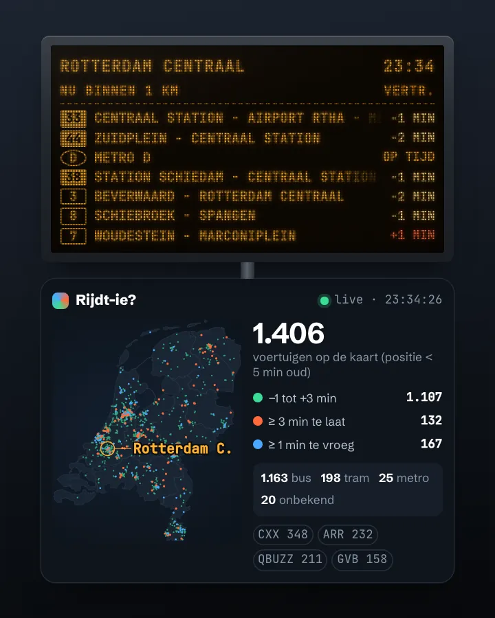 MapLive map of buses, trams and metrosA map on which every bus, tram and metro in the Netherlands moves live, coloured by delay, from one open 180 kB file and without a key.Getting started
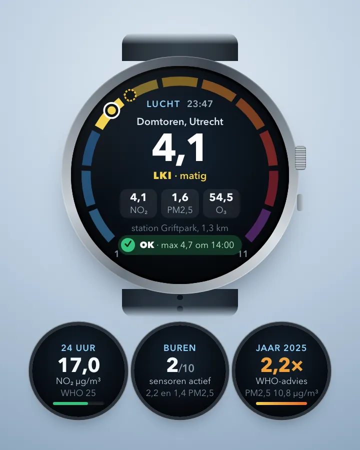 AlertAir quality alert for your own streetA notification on your phone when the air at home is bad or about to get bad, based on the Luchtmeetnet forecast, the monitoring stations in your city, neighbours' sensors and the RIVM annual map.Getting started
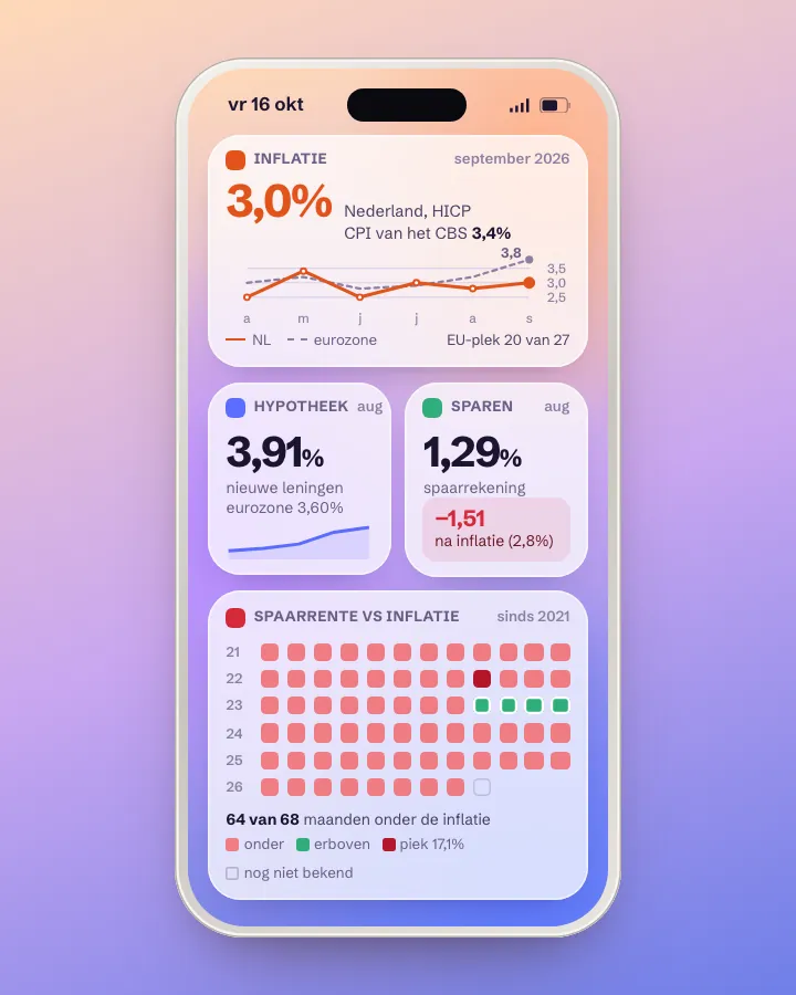 DashboardMonitor for inflation, mortgage rates and savings ratesOne dashboard that shows every month how fast prices rise, what a new mortgage costs and what savings earn, in the Netherlands and the euro area.Getting started
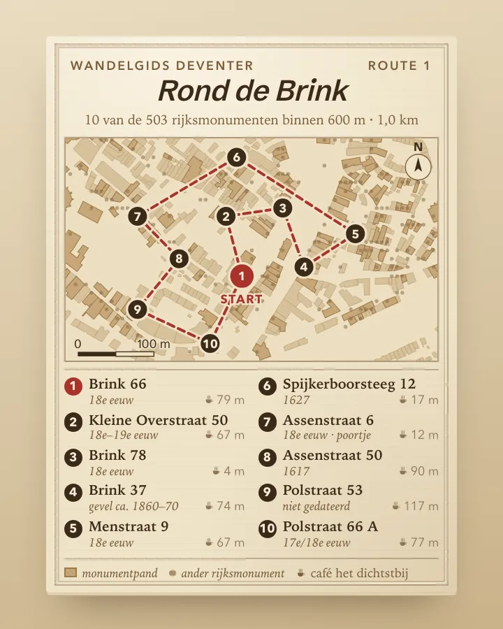 AppA monument walk through your own neighbourhoodAn app that builds a walk past ten listed monuments around any starting point, with address, description, photo, a historic image from the Rijksmuseum and a café on the way.Getting started
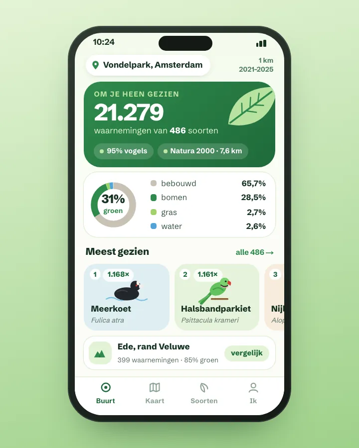 AppNature in your neighbourhood: which species were seen and how green is it?An app that shows, for any point in the Netherlands, which plants and animals were observed within 1 km, how much of the land is green and how far away the nearest Natura 2000 site is.Getting started
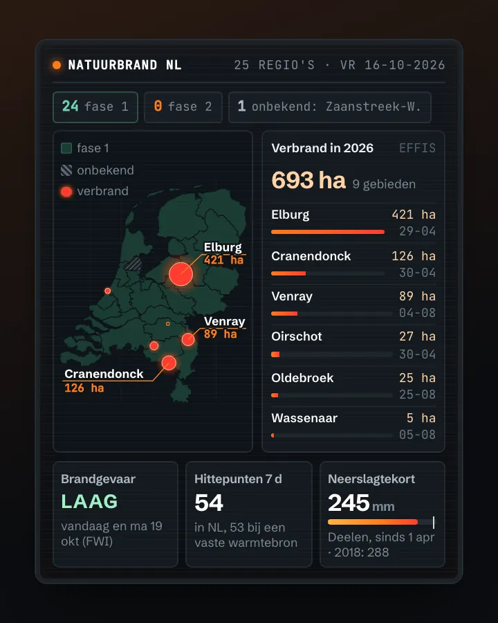 MapWildfire map: today's risk, hotspots and burnt landOne map of the Netherlands per safety region with the fire service's phase, the fire danger for today and the coming days (EFFIS), the hotspots satellites saw this week (without factories) and the land that burnt this year, with KNMI drought data alongside.BAdvanced
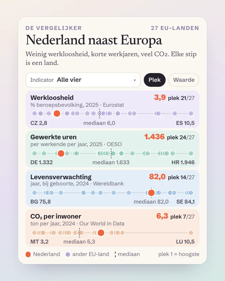 ToolThe Netherlands next to Europe: a comparison tool for any indicatorPick a figure (unemployment, hours worked, life expectancy, CO2) and see at once where the Netherlands ranks among the 27 EU countries, with four international sources behind one button.Advanced
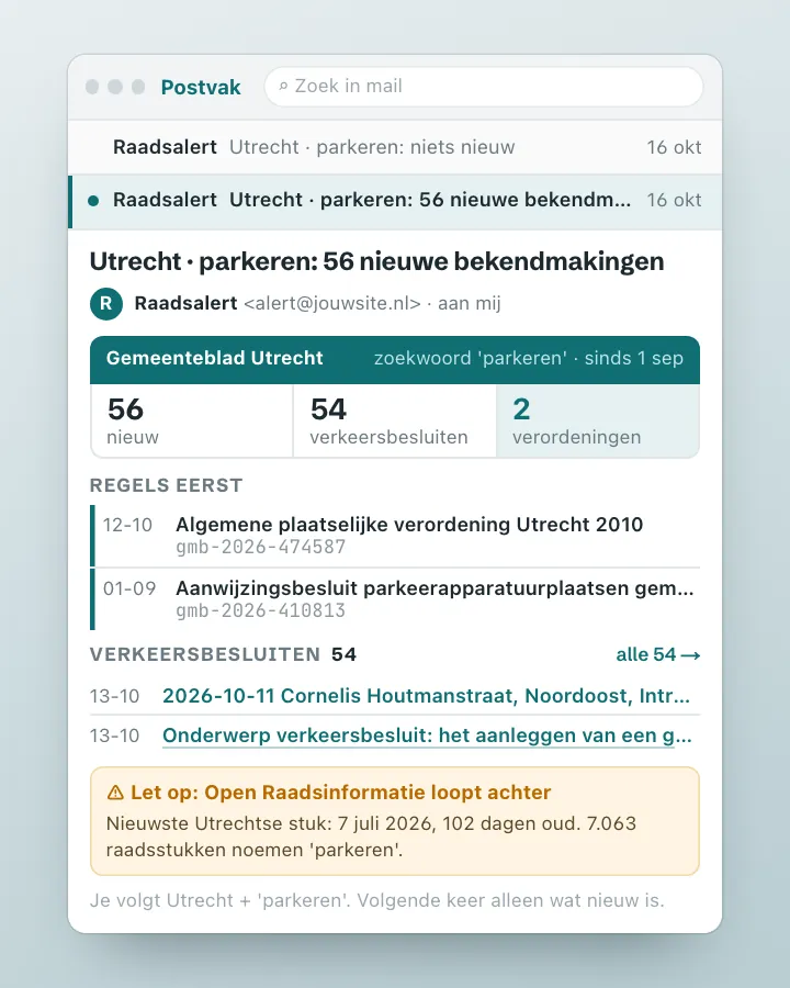 AlertCouncil decision alert: a ping when your municipality decides somethingA script that searches your municipality's official announcements for your topic every day, reports only what is new, and adds what the council discussed about it earlier.Getting started
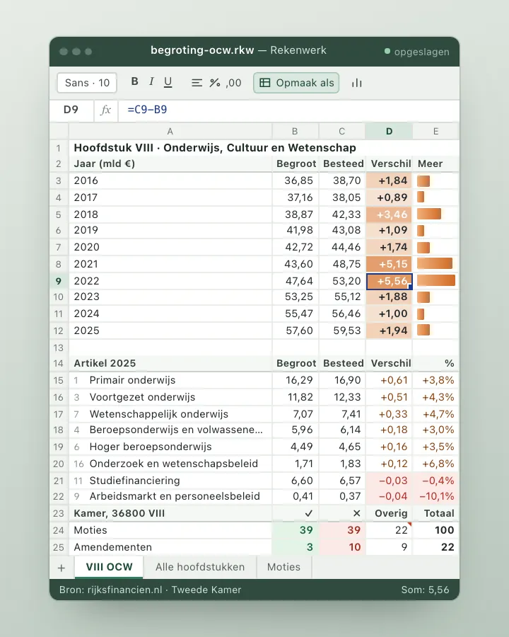 DashboardNational budget tracker: budgeted against spentTrack per ministry and per budget article what central government planned to spend and what it actually spent, year after year, with the motions and amendments the House filed on it.Advanced
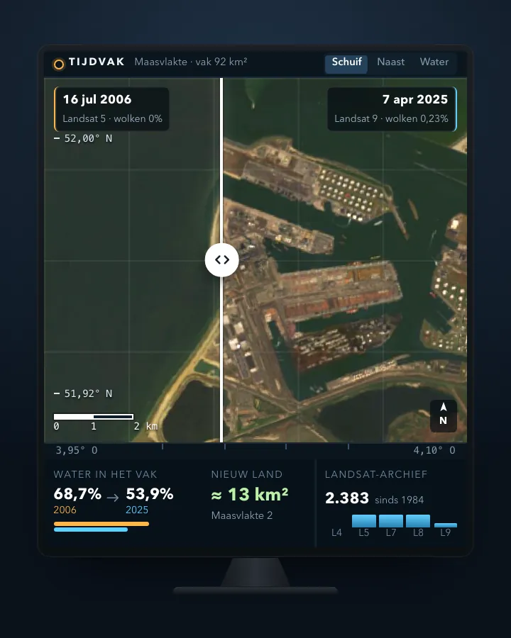 ToolSatellite before and after: see how your town or polder changedPick a place and two years, and get two cloud-free satellite images side by side with a slider, plus a calculation of how much water became land.Advanced
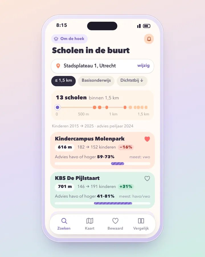 ToolSchool finder: primary schools around your address, with pupil numbers and school adviceType a postcode and house number and see every primary school within a radius, sorted by distance, with their pupil numbers over the years and what share of the children got a havo or vwo advice. Only open data from DUO and the BAG.Getting started
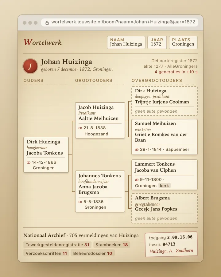 AppFamily tree finder: from one record to your great-grandparentsStart with a birth record and let the app search back generation by generation through the marriage records of hundreds of Dutch archives, with a link to the National Archives inventory.Advanced
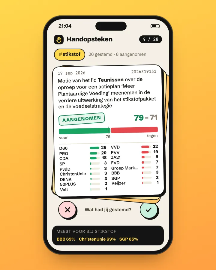 AppVoting tracker: how did each party vote?Search a topic and see how each party in the House of Representatives voted on the motions about it: how often for, how often against, and which motions passed.Getting started
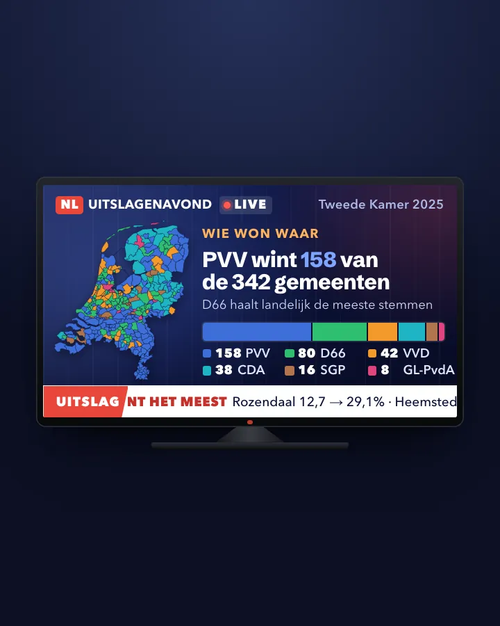 MapElection map: result, shift and turnout per municipalityA map of all 342 municipalities with the largest party, the gain or loss since the previous election and the turnout, next to income per resident.Advanced
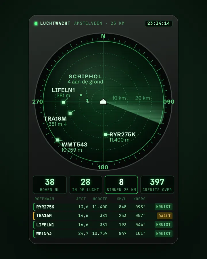 AppWhat is flying over my house right now?A small app that shows every few minutes which aircraft are within 25 km of your address, how high, how fast and whether they are climbing or descending, using OpenSky's live positions and without an account.Getting started
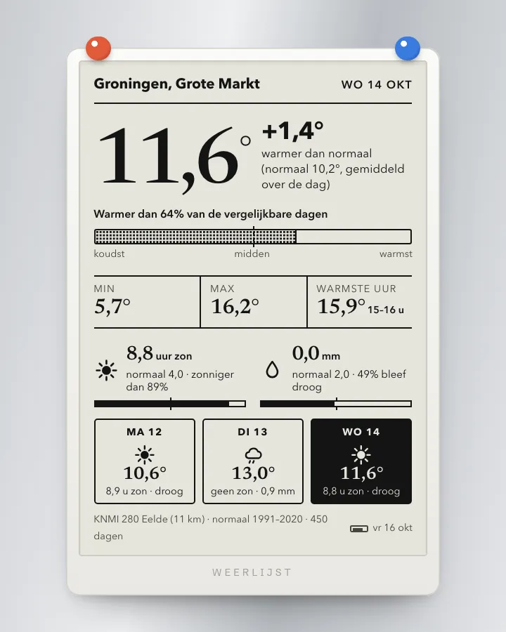 AppWeather app for your own place: warmer, wetter or sunnier than normal?A small app that picks the nearest KNMI station and tells you how the latest day compares with the same time of year in 1991-2020: in degrees, millimetres and hours of sunshine, and as a percentile.Getting started
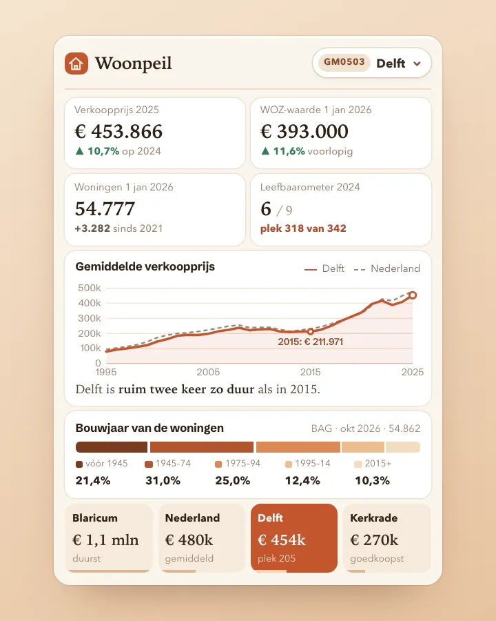 DashboardHousing market dashboard for your municipalityOne page per municipality with sale prices, WOZ value, housing stock, construction years, dwelling size and liveability, next to the national average. All from open APIs without a key.Advanced
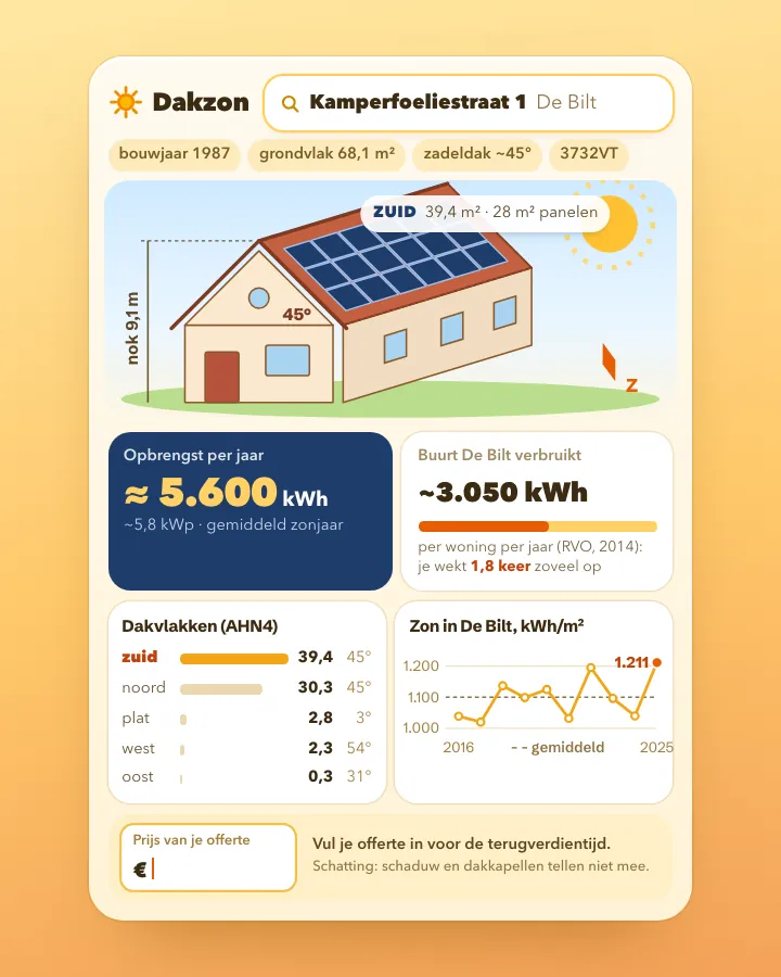 ToolSolar panel check for your own roofType a postcode and house number and see how large your roof surfaces are, which way they face, how much sun falls on them and roughly what panels would yield, using open data from BAG, AHN, KNMI and RVO.Advanced
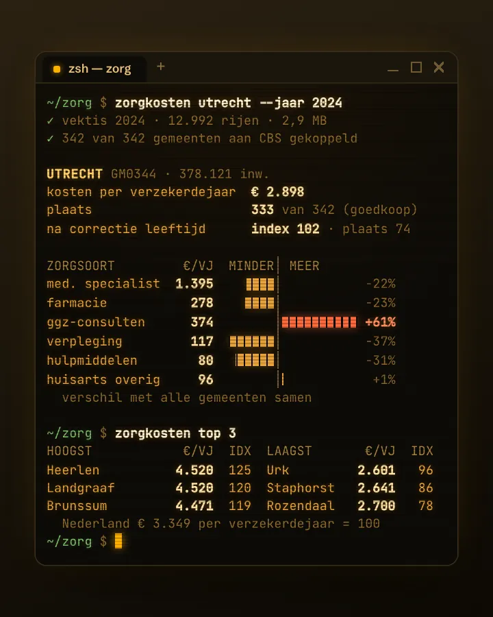 ToolHealthcare cost comparer per municipalityA tool that shows what basic health insurance spends per resident in your municipality, per type of care, and how that compares with the rest of the Netherlands, also after correcting for age.Getting started